


WHAT WE'RE TRACKING:
COPYRIGHT 2024 BY CHANNEL 3000. ALL RIGHTS RESERVED. THIS MATERIAL MAY NOT BE PUBLISHED, BROADCAST, REWRITTEN OR REDISTRIBUTED.
- Sunshine continues Thursday
- Morning lows in the 40s through Friday
- Rain returns Friday night


PLANNING THE NEXT 24 HOURS: Nighttime and daytime temperatures remain slightly below normal Thursday and Thursday night before they climb back towards the average by Friday afternoon. Expect temperatures to only reach the lower 70s Thursday afternoon and Thursday night temperatures will once again fall into the mid 40s.
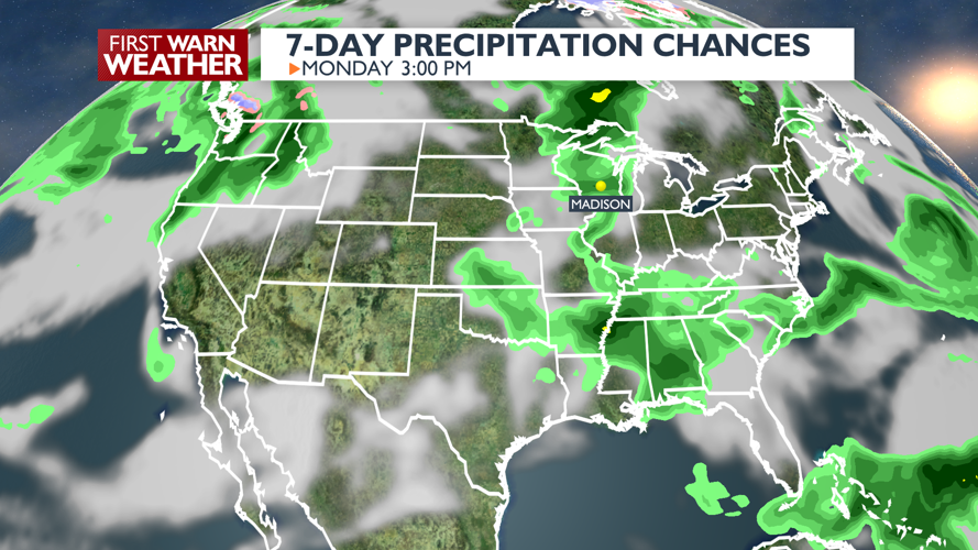
EXTENDED FORECAST: Friday and Saturday temperatures will warm into the mid 70s. A round of showers is expected Friday night into Saturday, but Saturday afternoon and evening should be mostly dry. Temperatures on Sunday will climb all the way into the upper 70s/lower 80s across southern Wisconsin. Sunday most severe weather expected to stay to our northwest but Monday we're calling for an ALERT DAY for strong to severe storms. More storms are possible through midweek next week.


COPYRIGHT 2024 BY CHANNEL 3000. ALL RIGHTS RESERVED. THIS MATERIAL MAY NOT BE PUBLISHED, BROADCAST, REWRITTEN OR REDISTRIBUTED.
Madison, WI
Right Now
- Humidity: 44%
- Feels Like: 66°
- Heat Index: 66°
- Wind: 7 mph
- Wind Chill: 66°
- UV Index: 8 Very High
- Sunrise: 05:21:58 AM
- Sunset: 08:29:51 PM
- Dew Point: 44°
- Visibility: 10 mi
Today
Mostly sunny and a little milder. Wind: SE 5-10 MPH
Tonight
Clear and cool. Wind: Light
Tomorrow
Becoming variably cloudy and very mild with a slight chance of showers and thunderstorms in the evening. Wind: S 6-12 MPH
Chance of Rain: 10%
Sunrise: 05:21:57 AM
Sunset: 08:30:02 PM
Humidity: 45%
Wind: SE @ 7 mph
UV Index: 8 Very High
Thursday Night
Clear and cool. Wind: Light
Chance of Rain: 20%
Sunrise: 05:21:25 AM
Sunset: 08:30:50 PM
Humidity: 41%
Wind: S @ 9 mph
UV Index: 6 High
Friday Night
Variable cloudiness and mild with scattered showers and storms late.
Chance of Rain: 50%
Sunrise: 05:20:56 AM
Sunset: 08:31:37 PM
Humidity: 54%
Wind: S @ 8 mph
UV Index: 7 High
Saturday Night
Variable cloudiness and mild.
Chance of Rain: 40%
Sunrise: 05:20:29 AM
Sunset: 08:32:23 PM
Humidity: 55%
Wind: SSW @ 7 mph
UV Index: 8 Very High
Sunday Night
Scattered showers and storms.
Chance of Rain: 50%
Sunrise: 05:20:04 AM
Sunset: 08:33:07 PM
Humidity: 57%
Wind: S @ 8 mph
UV Index: 5 Moderate
Monday Night
Mild with a chance of showers and storms.
Chance of Rain: 30%
Sunrise: 05:19:41 AM
Sunset: 08:33:50 PM
Humidity: 59%
Wind: SW @ 9 mph
UV Index: 8 Very High
Tuesday Night
Cloudy with a chance for showers and thunderstorms.
Chance of Rain: 30%
Sunrise: 05:19:20 AM
Sunset: 08:34:31 PM
Humidity: 60%
Wind: NW @ 7 mph
UV Index: 8 Very High
Wednesday Night
Partly cloudy with a slight chance of showers.
Chance of Rain: 10%
Sunrise: 05:19:02 AM
Sunset: 08:35:11 PM
Humidity: 56%
Wind: WNW @ 9 mph
UV Index: 8 Very High
Thursday Night
Partly cloudy
Chance of Rain: 20%
Sunrise: 05:18:45 AM
Sunset: 08:35:49 PM
Humidity: 56%
Wind: NW @ 10 mph
UV Index: 8 Very High
Friday Night
Partly cloudy
Chance of Rain: 20%
Sunrise: 05:18:31 AM
Sunset: 08:36:25 PM
Humidity: 69%
Wind: WNW @ 10 mph
UV Index: 8 Very High
Saturday Night
A few clouds. Low 53F. Winds WNW at 5 to 10 mph.