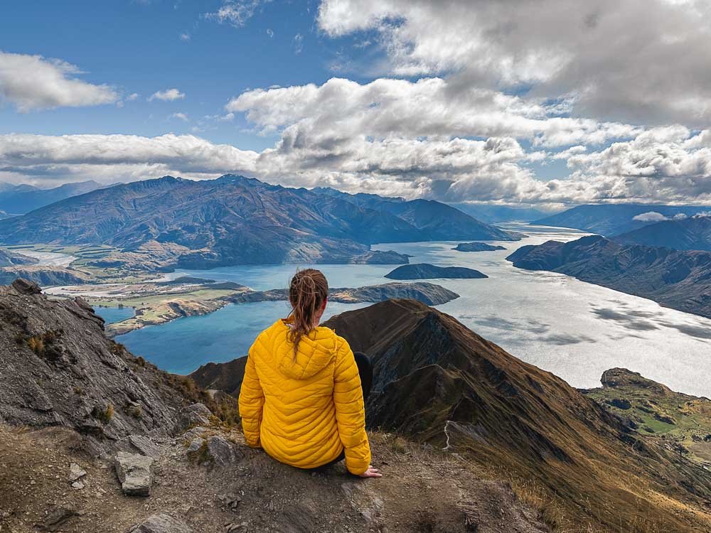
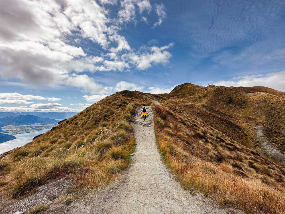
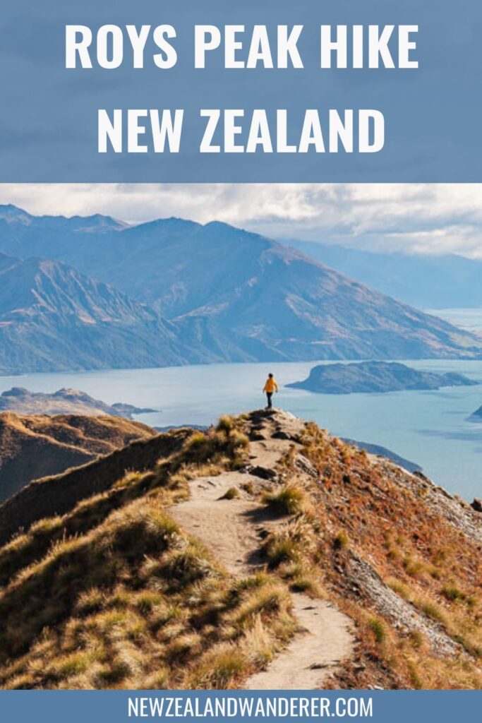
Roys Peak is one of the most photographed locations in New Zealand. Standing 1578 meters above sea level with expansive views over Lake Wanaka and the surrounding mountain ranges we can see why!
In this guide we’re sharing everything you need to know about hiking the Roys Peak track including updated transport options, how to avoid the crowds, parking, track difficulty and what to expect based on our own experiences.
This challenging track will test your endurance with a steep climb to the top where breathtaking views and beautiful landscapes of the South Island await you. It’s a bucket-list experience and not to be missed for any hiker visiting the South Island of New Zealand.

About Roys Peak
Roys peak is a challenging track located just outside the town of Wanaka that will test the endurance of even the fittest hikers. But once you reach the top the views are absolutely worth the effort to get there.
The track itself is easy, being a wide gravel farm track that zig-zags up the mountain following switchbacks until you reach the Roys Peak lookout. This Instagram famous viewpoint isn’t actually the top though.
The true summit is a further 30-minute hike from the viewpoint. The track becomes more rocky and uneven in sections between the viewpoint and the summit but nothing too hard or technical.
The real challenge comes from the relentless uphill climb of 1,258 meters (4,127 feet) over 8 kilometers (5 miles), which takes most people around 3 hours to complete. After, you’ll return via the same track in a continual downhill decent.

Key Info
| Difficulty: | Moderate to Hard |
| Fitness level: | Medium to High |
| Distance: | 16km (10 miles) return |
| Elevation gain: | 1,228 meters (4,028 feet) |
| Trail type: | Out and back |
| Time needed: | 5 – 6 hours |
| Starts from: | Roys Peak Track carpark, Mt Aspiring Road near Wanaka |
| When to go: | Track closed from 1 October to 10 November, otherwise open all year |
| Cost: | $2 coin via an honesty box at the start of the track |
You can check for any alerts on the DOC website, especially if there has been inclement weather. Fortunately, this track doesn’t experience closures like some of the other popular tracks.
FAQs
Is it worth hiking Roys Peak?
Yes! It isn’t the easiest track due to the elevation gain and continual uphill climb but the views truly are spectacular and worth the effort.
When is the best time to hike Roys Peak?
Our most preferred time to do the Roys Peak hike is for sunrise in mid to late autumn for less crowds, the best light and decent weather provided the weather forecast is for clear skies.
Where to start the Roys Peak walk?
The trailhead starts from the Roys Peak carpark located on Mount Aspiring Road, a 10 minute drive from Wanaka town center.
How hard is it to walk Roys Peak?
Roys Peak is difficult in that it is relentlessly uphill for nearly 3 hours straight. If you’re prepared for the conditions, wear comfortable footwear and take it at your own pace, it is manageable for most people. It’s a walk you’ll be happy you did but won’t be in a hurry to do again soon!
How long does it take to hike Roys Peak?
It takes most people between 5 and 6 hours to complete the return trip. The hike up takes on average 3 hours to the viewpoint and a further 30 minutes to the summit. It’s a little faster on the way down.
Is the Roys Peak Track closed?
The Roys Peak track is closed from 1 October to 10 November every year for lambing season. Apart from that, it is open all year.
Can you hike Roys Peak in winter?
Yes, as long as you are prepared for the conditions. We recommend only those with experience hiking in alpine conditions attempt the track during winter if the track is covered in snow. Icy conditions may require crampons and an ice axe to navigate safely, plus there is avalanche terrain above the 1000m mark. It’s best to check New Zealand Avalanche Advisory website or the Mt Aspiring National Park Visitor Centre to understand the conditions and risks before you go.
Roys Peak vs Ben Lomond – which is better?
Having hiked both Roys Peak and Ben Lomond, I recommend doing both if you can! The tracks are very different but both have epic views. Roys Peak is a gravel path following switchbacks up the same side of the mountain so the view, although spectacular, is the same the whole way. Ben Lomond is a more technical track with a variety of landscapes and viewpoints, which for me was a more interesting journey.
Both are challenging in different ways. Ben Lomond is more technical in a remote alpine environment whereas Roys Peak was mentally challenging due the non-stop elevation gain with no variety in the trail. A good level of fitness is required for both.
Best time to go
The best time to do this hike depends on personal preferences, conditions and your schedule.
However, our most preferred time to hike Roys Peak is sunrise in mid to late autumn for less crowds and comfortable temperatures.
Here are a few things to consider when deciding on the best time to hike Roys Peak.
Weather conditions
Be sure to check the weather conditions before setting off. If there is low hanging cloud or fog you won’t be able to see the views. Roys Peak can be seen from Wanaka town center so if the mountains surrounding Wanaka are covered by cloud, chances are you won’t have any views at the top.
If it’s raining or there has been recent heavy rainfall, the track may be quite muddy. Also, bear in mind there is no shelter on the track and you could be hiking in the rain for 5 hours or more. Visibility at the lookout and summit may also be poor.
Although not a technically challenging track, snow and ice in winter can make the journey a bit tricky. If there’s a lot of snow on the mountain you may need crampons, especially if you plan on hiking to the summit.
Time of day
The earlier you can start the less crowded it will be. Unless of course you are planning to hike for sunset in which case you’ll be starting later in the day.
An early start means a better chance of scoring a parking spot, better light for photos and less people on the track. Plus you’ll avoid the peak sun and heat which can be brutal on this exposed track in the summer months.
Seasons
Roys Peak can be hiked in any season. Let’s take a look at what to expect for each season.
Summer
The summer season officially runs from December to February in New Zealand with the average temperatures in Wanaka ranging between 20°C and 30°C (68℉ to 86℉).
The warmer temperatures and longer daylight hours are a bonus, however it is also peak season in New Zealand, with school holidays and overseas visitors escaping winter in the Northern Hemisphere.
Expect more people on the track, and likely a line of people waiting to get a photo at the lookout. The trail is completely exposed and the sun can be intense during the middle of the day.
If hiking in summer, we recommend starting early in the morning for the best chance of getting a parking spot and to avoid the sun at its peak. Be sure to bring a LOT of water and protection from the sun.
Autumn
Autumn (or fall) runs from March to May and happens to be my preferred season for hiking Roys Peak for milder temperatures and less crowds.
Average temperatures range between 5°C and 25°C (41℉ to 77℉) which is quite a spread so layers are essential. Expect crisp mornings and warm sunny days, although snow is possible as early as April.
Crowds start to thin from late March, which is when we went. It’s wan’t too busy and parking spots were available throughout the day, even in the afternoon.
There were a few people at the lookout, but not a line as such. It was hot on the way up and cold and windy at the summit so we utilised all the layers, from a t-shirt to a puffer jacket.
Spring
As mentioned, the track is closed for 6 weeks in spring from 1 October to 10 November for lambing. The spring season officially runs from September to November with the average temperatures ranging between 8℃ and 22℃ (46℉ to 71℉). September tends to be quite chilly with temperatures warming up by late November.
Spring is considered to be a shoulder season and a quieter time of the year to travel in New Zealand. However, the weather can be unpredictable with lots of rain showers and possibly even snow early in the season.
Winter
Winter runs from June to August with the average temperatures ranging between 5℃ and 9℃ (41℉ to 48℉). The days are short and crisp, often calm with clear blue skies. Temperatures can drop into the minuses during the night so mornings can be frosty and snow is possible.
Roys Peak can be hiked in winter as long as you’re well prepared for the temperature and elements. If there is a lot of snow on the mountain you should only attempt this hike if you have experience hiking in alpine conditions.
What to bring
Regardless of the season you’ll be hiking in, we suggest wearing layers that you can adjust to stay comfortable, including a warm layer for the top. It can be very windy and chilly at the summit even in summer.
Sturdy and comfortable footwear is essential. The track can be walked in trainers (sneakers) in summer and autumn if conditions are dry. In fact, we wore hiking boots on a warm dry day in autumn and wished we had worn trainers.
In winter, spring or if it’s been raining, hiking boots are the better option. Also, the track gets a little rougher from the saddle to summit, so you may want to wear boots if you need the extra ankle support.
Here are some other essentials we recommend taking based on our own experience.
- Plenty of water, at least 1 litre or more during summer (there is no water on the track).
- Sunscreen and sun protection including a sunhat and sunglasses (also useful to protect your eyes from the wind in winter).
- Plenty of snacks to keep the energy levels up.
- A head torch or flashlight if hiking for sunrise or sunset.
- Crampons and ice axe if there is lots of snow or ice on the trail.
- Hiking poles aren’t essential but would be a bonus for the knees on the way down!
- Warm layers and a waterproof/windproof jacket.
- Small first aid kit with band-aids (plasters) for blisters (speaking from experience!).
- Extra bag for rubbish, be sure to take everything with you when you leave.

How to get there (2024 update)
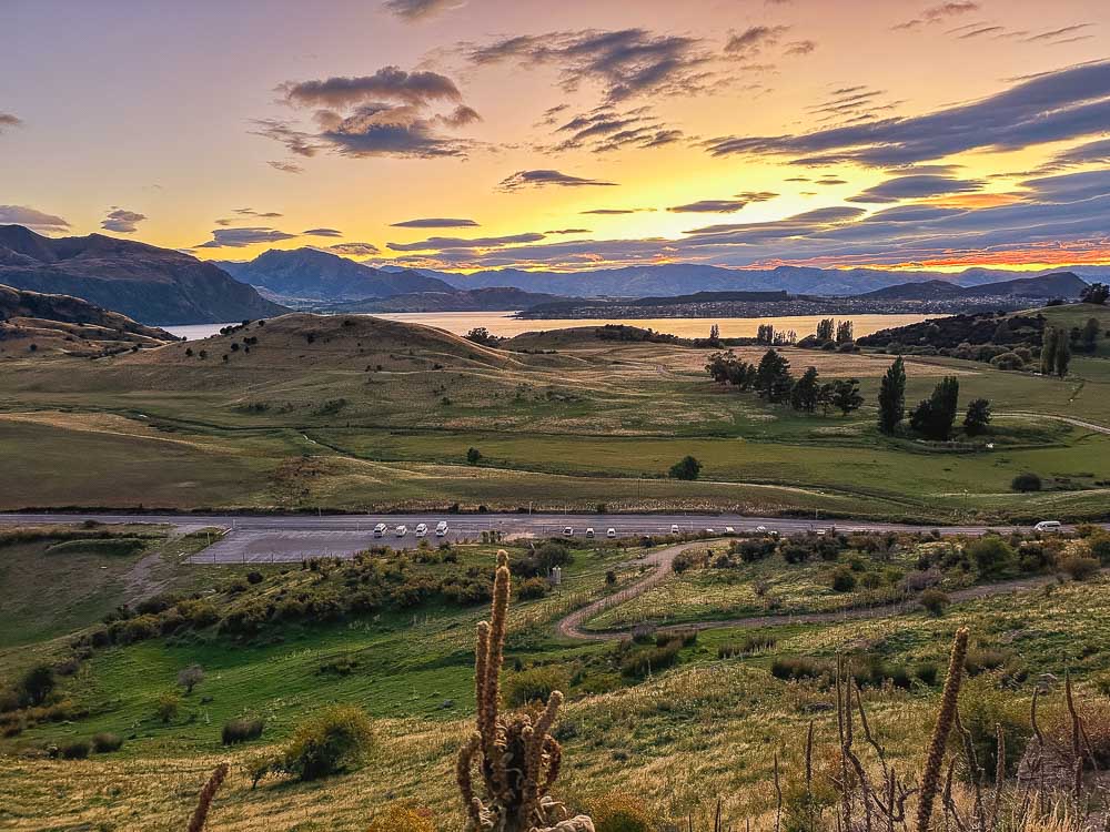
The Roys Peak carpark is on Mount Aspiring Road, 6 kilometers (3.7 miles) from Wanaka town center. It takes less than 10 minutes to get there by car from Wanaka and around an hour from Queenstown.
If you’re looking for transport from Queenstown to Roys Peak, Ritchies run a shuttle service between Queenstown and Wanaka that drops you off at the lakefront in Wanaka’s town center for $40 one way, $80 return. From town center, you have a few options to get to Roys Peak trailhead.
There isn’t any public transport that goes to the Roys Peak carpark so you will need a car or bike to get there, or you can take a taxi or shuttle from Wanaka. Yello! Taxi has a lot of cabs and cost around $30 for up to 5 people.
Or you can try Wanaka Bike Tours, which run a shuttle to the Roys Peak parking lot for $99 NZD each way for up to 4 passengers, additional passengers are $25 NZD each.
The Roys Peak carpark is large with a generous number of parking spots, but it can fill up by mid-morning during the peak summer months. If you plan on visiting between December and February, try to get there before 9am.
You may see people parked along the street if the lot is full, but it’s actually illegal and you could end up with a hefty fine. It’s also dangerous and we don’t recommend doing this. Your best bet is to get there early or wait for someone to leave.
Parking should be less of a problem outside of the peak summer months.
Track difficulty
The Roys Peak hike is rated as hard for the fact you will be climbing uphill for several hours. A good level of fitness is needed for this one. Most people find it manageable if they come prepared and take breaks as needed.
The track itself is a wide gravel path that follows switchbacks as you zig-zag your way up the 1,228-meter ascent. There are several short cuts across the switchbacks, most of which are even steeper than the main track, that you can take if you have the energy.
The track is also very exposed so hot sun, rain and wind could certainly add to the challenge. The walk back down goes much faster but can be a little rough on the knees. Walking poles would help.
Usually I find tracks to be a little easier than the official difficulty rating and because of this we underestimated just how hard the uphill slog would be. It was as difficult as everyone said it would be and takes endurance and determination to get to the top.
But once you are there, you’ll see why it’s one of the most photographed views in all of New Zealand.
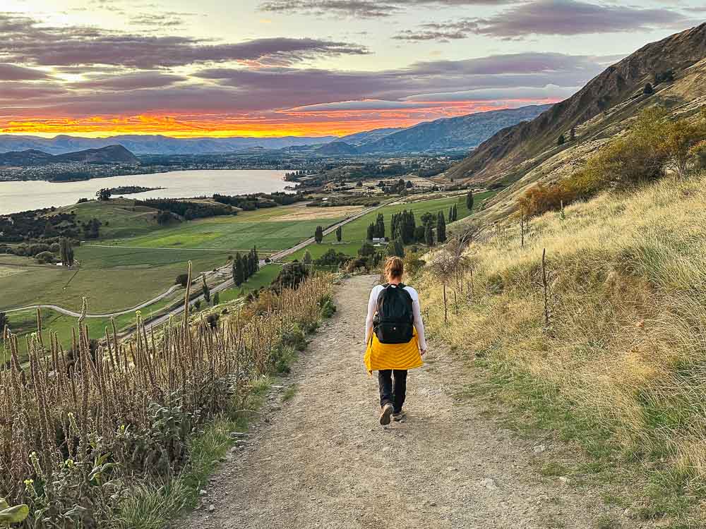
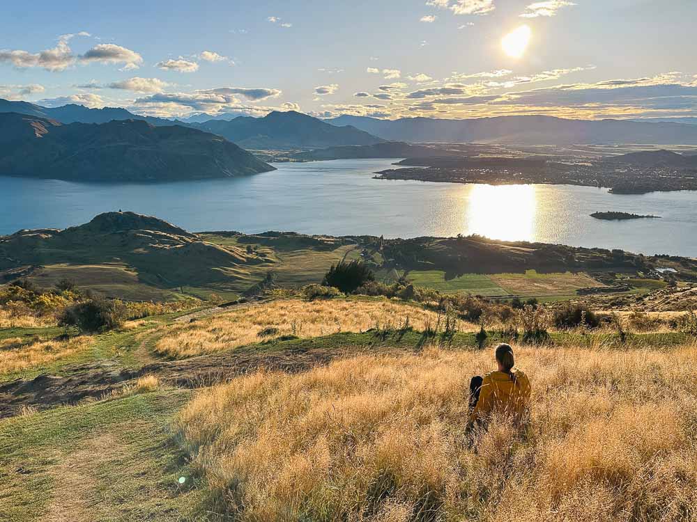
Hiking Roys Peak for sunrise
Hiking Roys Peak for sunrise is the best time to go for fewer people, amazing light and guaranteed parking at the trailhead. Plus in the summer months, you’ll avoid the sun on the way up.
Being a wide gravel path, the track is easy to navigate in the dark. The fact you can’t see how far you still have to go as you make your way up is a bonus. When we hiked in the daylight we kept looking up and the top didn’t seem to be getting any closer. In the dark you just keep going.
You’ll need a head torch or flashlight to navigate around any sheep poo and cow pats and to watch your step as you get near the top, it’s pretty high up there!
Your start time will depend on your pace. We recommend getting to the viewpoint around 30 minutes prior to sunrise. It takes around 3 hours for most people to get to the lookout. It will be cold at the top, even in summer, so make sure you have layers to put on while you wait for the sun to come up.
If an early morning start isn’t possible, sunset is another good alternative for fewer people and beautiful light. It may be busier than at sunrise but not as busy as the middle of the day. You should be able to get a park late afternoon as many day hikers will be finishing around that time.
About Roys Peak Track + Highlights
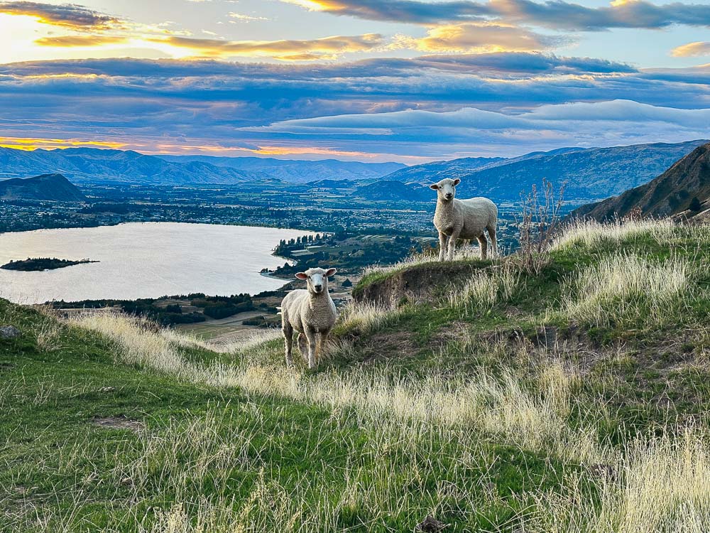
The gravel track up to Roys Peak crosses private land and is shared with livestock. Be sure to stick to the track and be respectful of the animals. Also, as mentioned, watch out for steaming cow pats on the track!
Start of the track
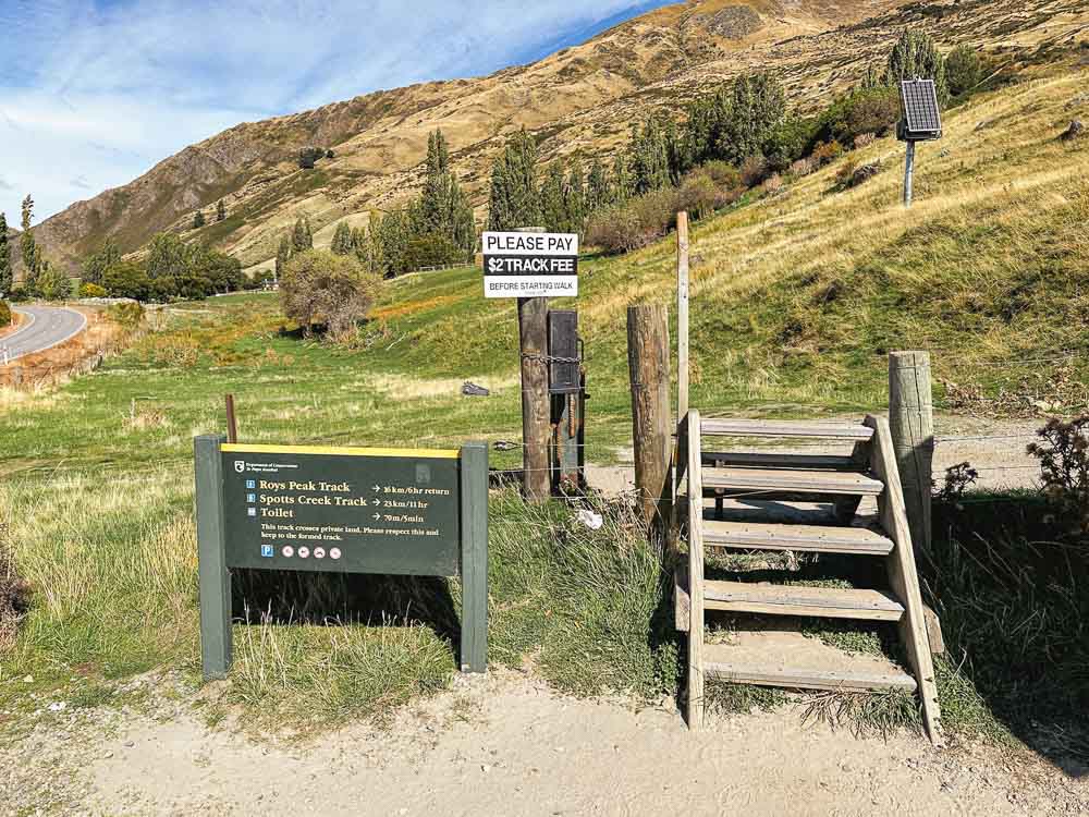
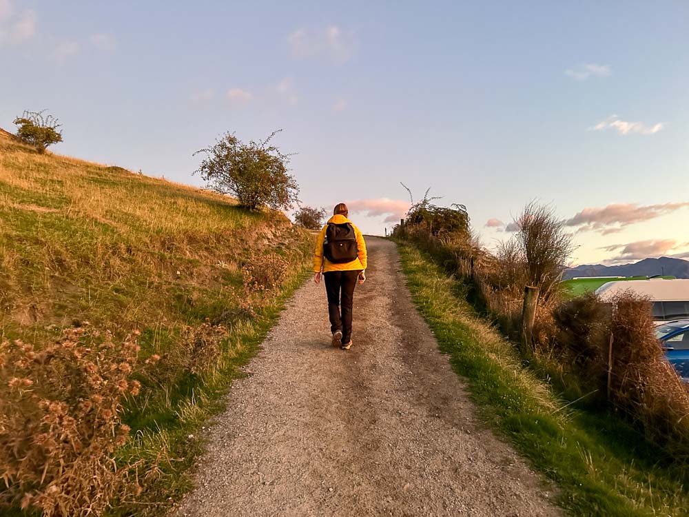
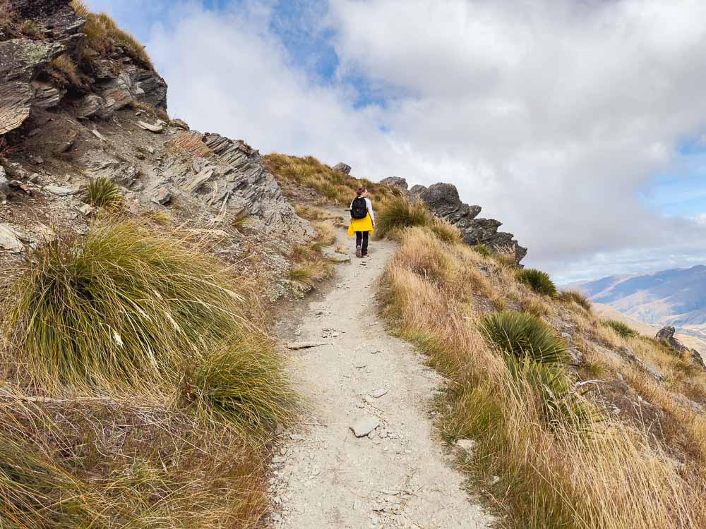
From the carpark, there’s a stile to step over to get to the start of the track and an honesty box right next to it where you can pop in a $2 coin. The track becomes an uphill gradient almost immediately on a well-formed gravel path.
The first half hour is a steep uphill walk and you’ll see views overlooking the carpark and further out to Lake Wanaka pretty quickly.
You’ll come to a second stile after about 40 minutes and then a section of the track that is covered in grass for a bit. This section, although still walking uphill, is slightly less steep for about 20 minutes. There is also a little bench about 40 to 50 minutes in.
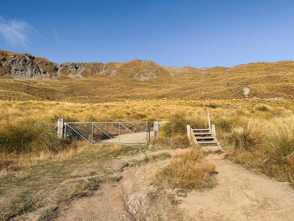
Around the 1 hour mark, you’ll come to a second stile and the track becomes steep again for the rest of the way to the lookout.
You’ll be meandering across the mountain along switchbacks with shortcuts across a few of them. Some of the shortcuts on the lower part of the track are easy but get more steep and rugged as you gain elevation.
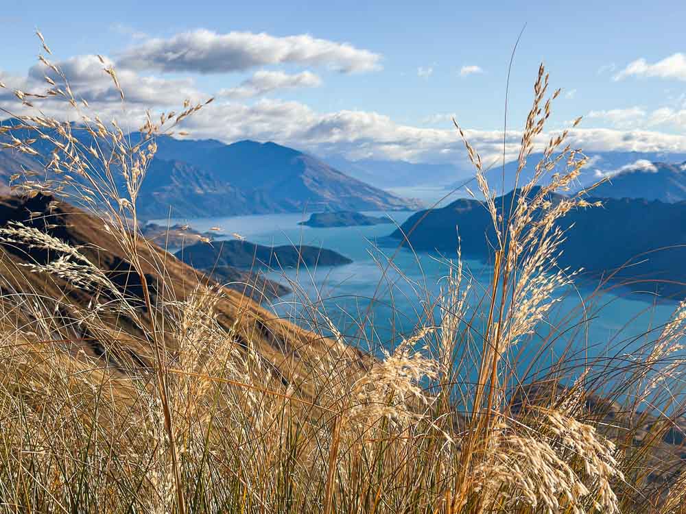
As you’ll be travelling up the same side of the mountain for the whole journey, the view stays the same but gets more magnificent the higher you climb, with sweeping views across Lake Wakatipu as far as the eye can see. We stopped a lot on the way up to take photos (and catch our breath).
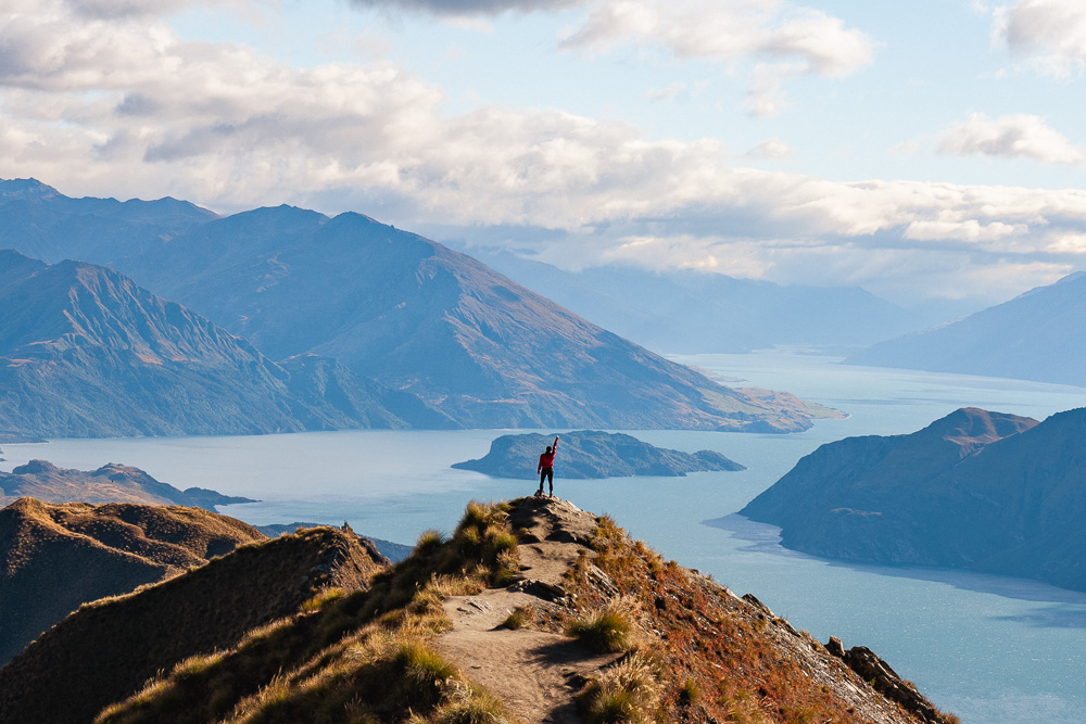
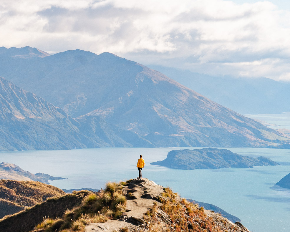
As you climb the final switchback you’ll see the sign for the viewpoint and that famous view!

Roys Peak Viewpoint
From the viewpoint you’ll see the path leading up to the famous lookout and selfie spot where the bays merge with Lake Wakatipu dotted with little islands and Mount Aspiring as the backdrop.
There were a few other people around when we arrived at the viewpoint mid-morning in late March. Everyone took turns and helped each other out to get photos.
If there is a line it should move fairly quickly and it’s best to form the line at the top of path leading to the selfie spot. Otherwise you won’t be able to get the leading line of the path without people in it.
If it happens to be super busy when you arrive, we suggest waiting it out for a bit or head up to the summit and try again on the way back down. There is also a toilet near the viewpoint in case you need it.
The summit is a further 30 minutes of walking from here. If hiking to the viewpoint is what you came for, then once you’ve soaked it all in you can head back down via the same track. It’s a massive effort just to get this point so good on ya!
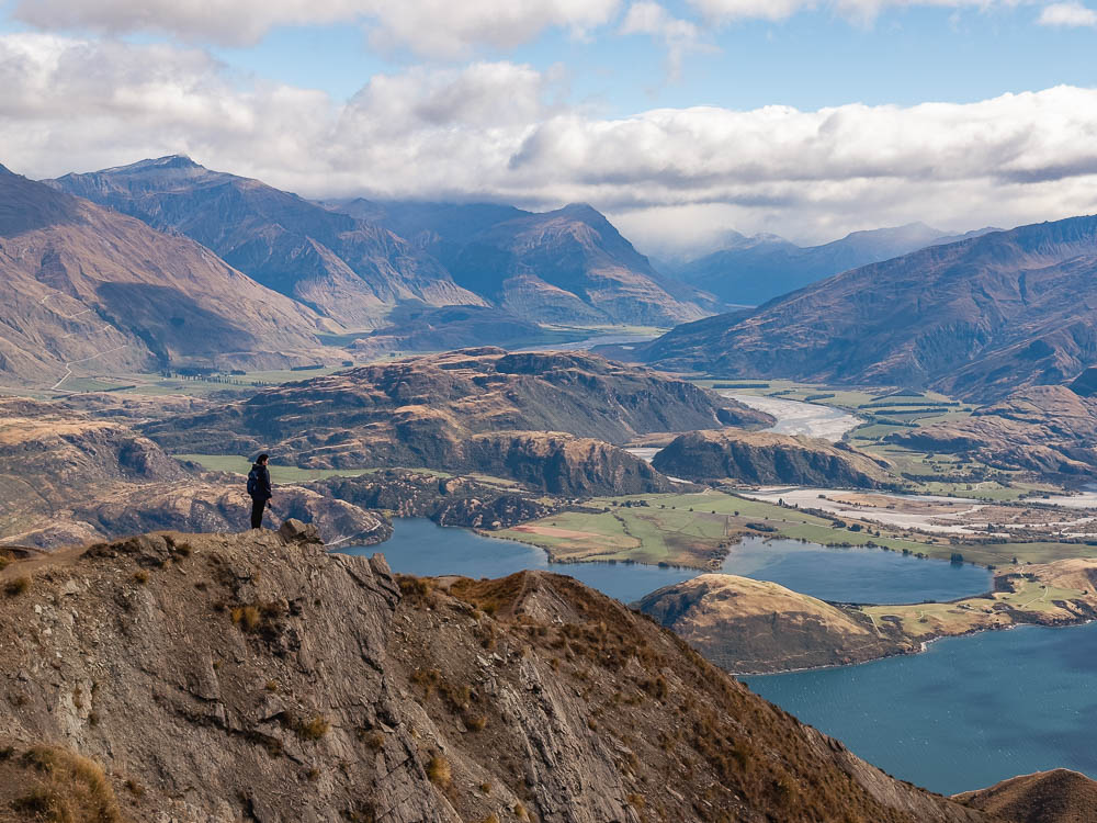
Roys Peak Summit
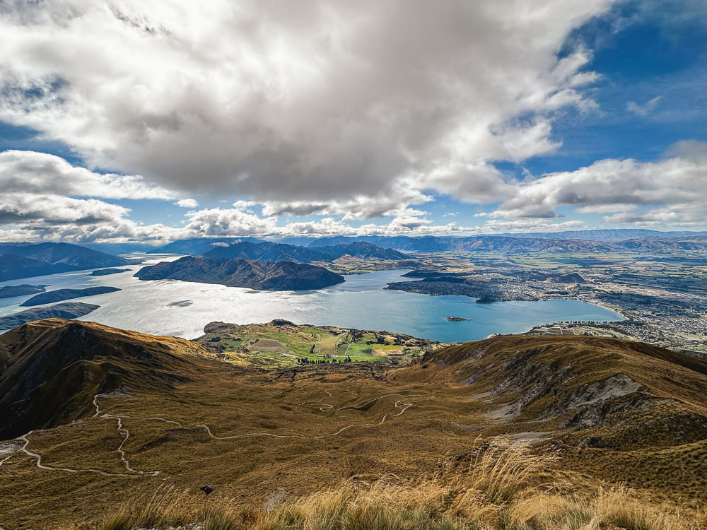
If you’re keen to see the summit then continue following the track past the viewpoint. The track gets a little rougher but it isn’t hard.
Once you reach the end of the first switchback you’ll see views from the other side of the mountain which are pretty spectacular with the lake below as you round the corner and then layers of textured mountains on the other side.
There are two shortcuts to the summit. One looked like it was practically vertical but we were warned by another hiker who had taken that one by mistake and made sure we stuck to the main track.
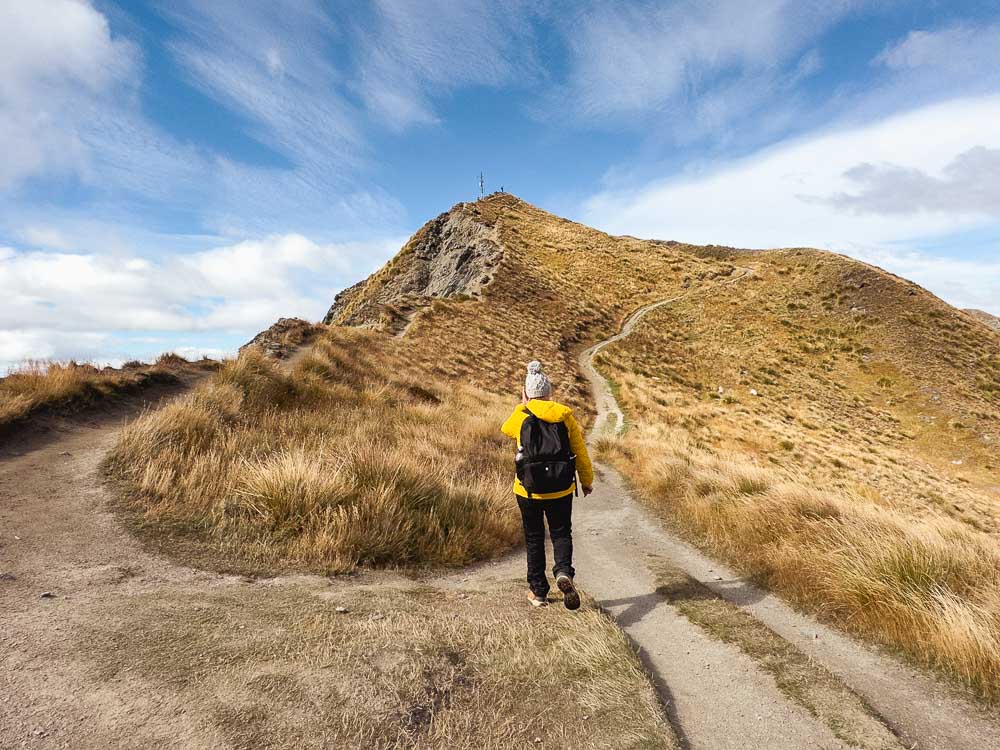
On the final stretch, you’ll see a split in the track. The path to the left walks along the ridgeline to the summit for more of a challenge, and the path to the right is the main track that continues on a gradual incline to the summit.
From the top you can see just how far you’ve walked! There was hardly anyone up there and the views were pretty spectacular spanning from Matukituki valley to Mt Aspiring and across the upper Clutha to the Pisa Range. It was super windy so we didn’t stick around for too long but are so glad we did it.
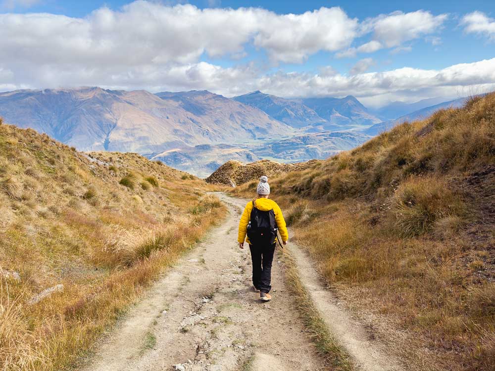
The descent
The hike back is via the same path and as much as I’d like say it was a lot easier, it was a challenge for different reasons.
It’s the same views so the excitement levels are much less than the way up and it is really tough on the knees. We also hit a couple of wind tunnels on the way down which blew a ton of dirt and debris up the track at us.
It took us 1.45 hours to get down (2.45 hours on the way up). Definitely worth the effort, and it was a great sense of accomplishment (and relief) once we reached the carpark. We were definitely ready for a good meal and a cold drink!

Helpful tips
- Bring a $2 coin for the honesty box which goes toward keeping the track maintained.
- There are toilets at the beginning of the track and at the viewpoint.
- Hiking boots are not necessary in summer and autumn when conditions are dry.
- Bring LOTS of water, especially in summer, as the track is very exposed.
- Allow plenty of extra time for stops and photos on the way up.
- There are shortcuts across the switchbacks, some of which are steep and narrow if you are looking for a bigger challenge, otherwise stick to the main trail.
- There are sheep and cows along the track so watch out for poo.
- It may be cold and windy at the top regardless of the season so be sure to bring a warm layer with you.
Conclusion
Roys Peak is one of the most popular hiking trails in New Zealand and with those views it’s easy to see why. It’s a challenging hike that will test even the fittest but the views make it all worth it! Despite the hype and potential crowds, this is a track worth taking on.
Pin for later!
YOU MIGHT ALSO LIKE


Heather is a travel enthusiast living in New Zealand with her family. She writes about living in and enjoying travel to New Zealand.
Thankyou so much for an awesome guide! Amazing! My 10yr old son & I are heading to Queenstown in 3 weeks and will be doing this hike with all your wisdom in tow.
I’m so glad you found it helpful. How wonderful to experience this awesome hike with your son. Be safe and have a fantastic time!