Glasgow City
Glasgow City is in Scotland, United Kingdom.Notable Places in the Area
Kelvingrove Art Gallery and Museum
Museum

Photo: Zhi Yong Lee, CC BY 2.0.
Kelvingrove Art Gallery and Museum is a museum and art gallery in Glasgow, Scotland, managed by Glasgow Museums.
Hampden Park
Stadium

Photo: Blackcat, CC BY-SA 3.0.
Hampden Park is a football stadium in the Mount Florida area of Glasgow, Scotland, which is the national stadium of football in Scotland and home of the Scotland national football team.
Glasgow Rangers
Stadium
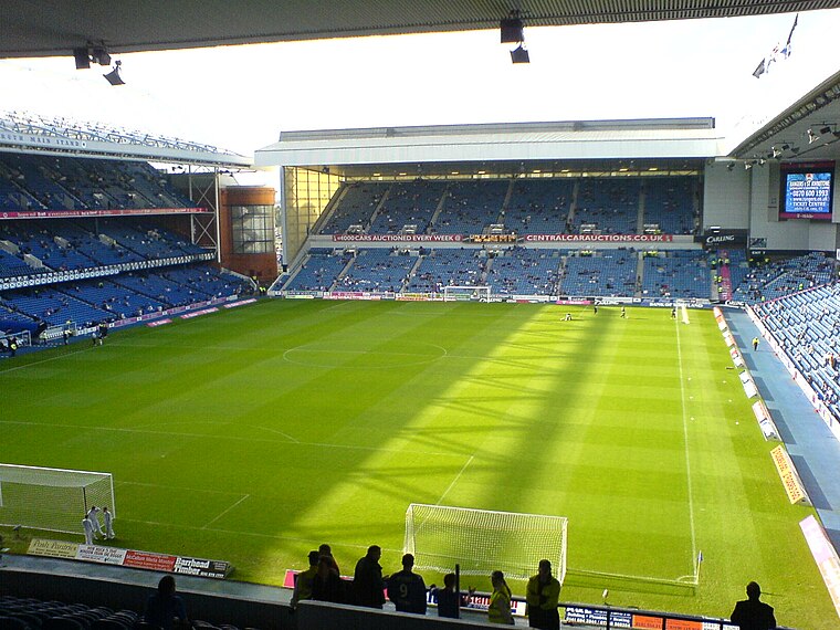
Photo: Archibald99, Public domain.
Ibrox Stadium is a football stadium on the south side of the River Clyde in the Ibrox area of Glasgow, Scotland.
Localities in the Area
Glasgow

Photo: Wikimedia, CC BY-SA 3.0.
Glasgow is a city on Clydeside in the Central Belt of Scotland.
Bearsden

Photo: Wikiwayman, CC BY-SA 3.0.
Bearsden is a town 6 miles northwest of Glasgow in East Dunbartonshire on Clydeside, with a population of 28,470 in 2020.
Milngavie
Photo: Andy Mitchell, CC BY-SA 2.0.
Milngavie is a town in Clydeside in the Central Belt of Scotland.
Glasgow City
Latitude
55.8667° or 55° 52' northLongitude
-4.25° or 4° 15' westPopulation
615,000Elevation
141 feet (43 metres)Abbreviation
GLGOpen Location Code
9C7QVQ82+M2GeoNames ID
3333231Glasgow City Satellite Map
© OpenStreetMap, Mapbox and Maxar
Other Places Named Glasgow City
Localities in the Area
- TradestonSuburb
- DennistounSuburb
- FinniestonSuburb
- SpringburnSuburb
- Kinning ParkSuburb
Landmarks in the Area
- Monkland CanalCanal
- Heatherbank Museum of Scial WorkMuseum
- Buchanan StreetShopping center
- Museum of PipingMuseum
- Glasgow Queen Street railway stationRailway station
Escape to a Random Place
Discover other destinations in the world.
About Mapcarta. Thanks to Mapbox for providing amazing maps. Text is available under the CC BY-SA 4.0 license, excluding photos, directions and the map. Photo: Ritchyblack, FAL.