Rwanda Map – Cities and Roads
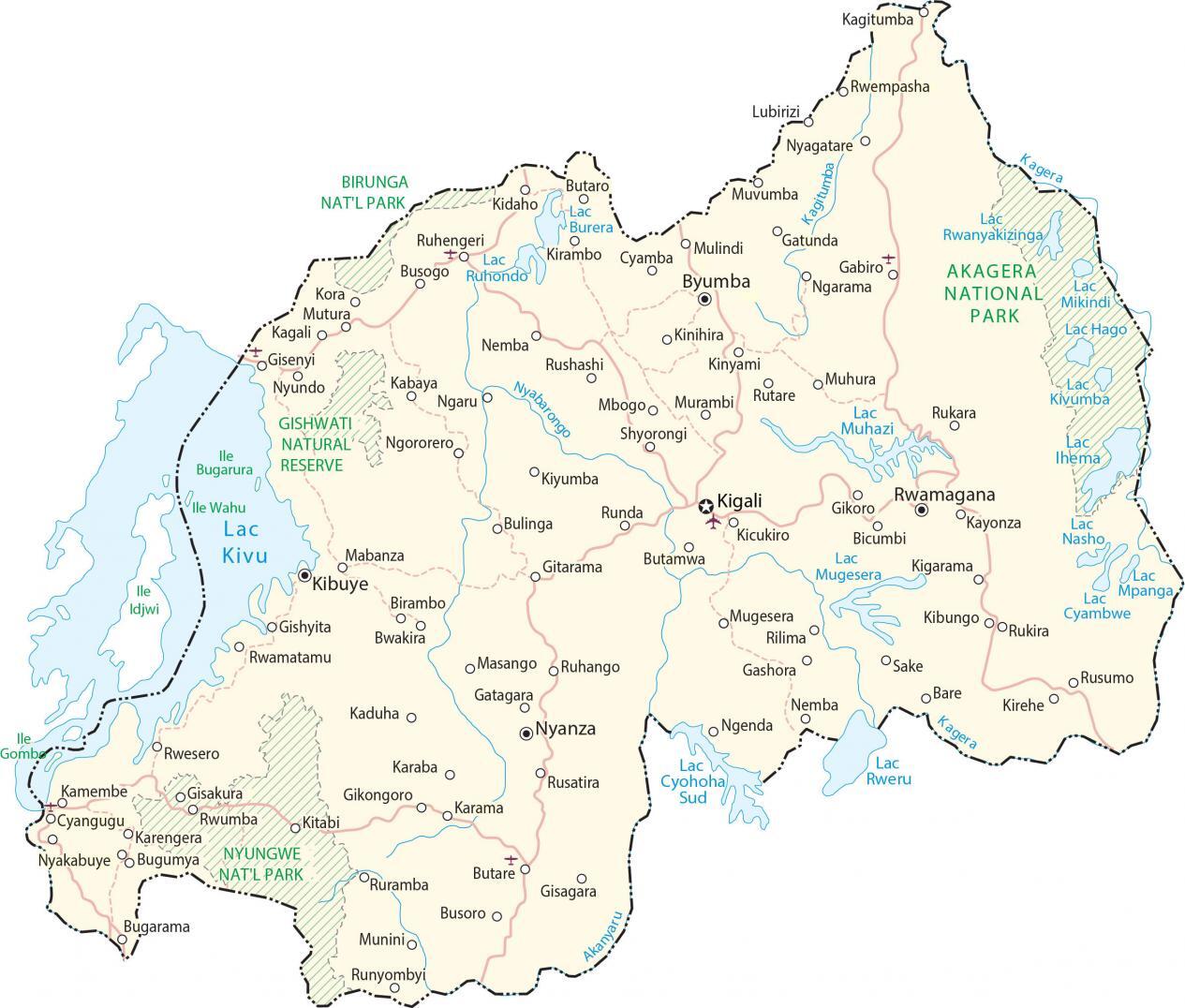
This map of Rwanda displays cities, roads, water, satellite imagery, and elevation. It also contains prominent geographic features like the African Great Lakes and the Albertine Rift Mountains.
Rwanda map collection
You are free to use our Rwanda map for educational and commercial uses. Attribution is required. How to attribute?
About the map
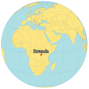
Rwanda is a landlocked country located in the central region of Africa. It’s situated slightly below the equator and is part of the Great Rift Valley.
Rwanda borders 4 other countries including Burundi to the south, Tanzania to the east, Uganda to the north, and the Democratic Republic of Congo to the west.
Kigali is the capital and most populous city in Rwanda. Other major cities include Butare, Gitarama, and Ruhengeri.
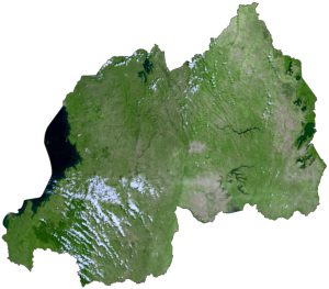
SATELLITE IMAGERY
Rwanda Satellite Map
Rwanda is one of the smaller African countries occupying an area of 26,338 square kilometers (10,169 sq mi). In comparison, it’s larger than Djibouti but smaller than Burundi. Rwanda is known for its rivers and lakes because it’s part of the African Great Lakes.

For example, Lake Kivu, Lake Muhazi, and Lake Ihema are some of its largest lakes. The country has a mix of landscapes like savanna, forests, swamps, waterfalls, and plains. Because of its high elevation and equatorial location, it has a tropical climate with lower temperatures.
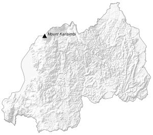
PHYSICAL MAP
Rwanda Elevation Map
Rwanda is nicknamed the “Land of a Thousand Hills” because rolling hills cover most of the interior. Its major mountain chain is the Albertine Rift Mountains to the west. These mountains straddle the western region in a north-south direction along Lake Kivu.

It contains the stratovolcano, Mount Karisimbi on the border between the Democratic Republic of Congo and Rwanda. At 4,507 m (14,787 ft), this is the highest peak in Rwanda. Whereas its lowest point is the Rusizi River at 950 meters (3,117 ft) above sea level. Overall, Rwanda lies at a high altitude in comparison to other African countries.
Capital City
Kigali
Major cities and towns
Butare
Byumba
Gisenyi
Kibuye
Kibungo
Muhanga
Nyagatare
Nyanza
Ruhengeri
Rwamagana
Cities, towns and villages
Bare
Bicumbi
Birambo
Bugarama
Bugumya
Bulinga
Busogo
Butamwa
Butaro
Bwakira
Cyangugu
Gabiro
Gatagara
Gatunda
Gikongoro
Gikoro
Gisagara
Gisakura
Gishyita
Gitarama
Kabuye
Kabaya
Kaduha
Kagali
Kamembe
Karama
Karengera
Karaba
Kayonza
Kicukiro
Kigarama
Kirambo Cyamba
Kirehe
Kinihira
Kinyami
Kitabi
Kiyumba
Munini
Murambi
Mushubati
Mutura
Mabanza
Masango
Mbogo
Muhura
Mulindi
Muvumba
Ngarama
Nemba
Ngenda
Ngororero
Nyakabuye
Nyundo
Rilima
Rukara
Runda
Rushashi
Rusatira
Rusumo
Rutare
Ruramba
Rwesero
Rwumba
Shyorongi
Lakes, rivers and water features
Kagera River
Kagitumba River
Lac Burera
Lac Cyambwe
Lac Cyohoha Sud
Lac Hago
Lac Idjwi
Lac Ihema
Lac Kivu
Lac Kivumba
Lac Mikindi
Lac Mpanga
Lac Mugesera
Lac Muhazi
Lac Nasho
Lac Thema
Lac Rwanyakizinga
Lac Rweru
Nyabarongo River
National parks and reserves
Akagera National Park
Birunga National Park
Gishwati Natural Reserve
Nyungwe National Park
Islands
lle Gombo
lle Idjwi
lle Wahu