Reading
Reading is a large, historic town in Berkshire in the South East of England. It is one of the largest towns without city status in the United Kingdom with just under 235,000 inhabitants.Notable Places in the Area
Reading Railway Station
Railway station
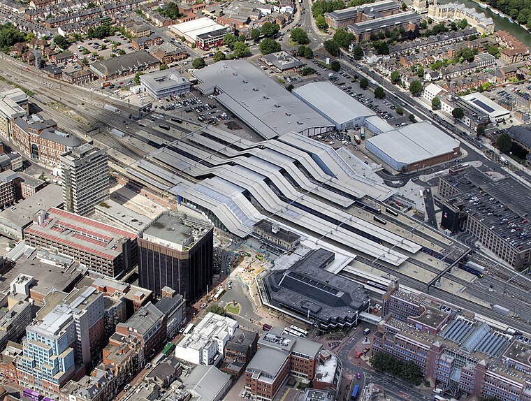
Photo: John Fielding, CC BY 2.0.
Reading railway station is a major transport hub in Reading, Berkshire, England; it is 36 miles west of London Paddington.
Madejski Stadium
Stadium

Photo: John Fielding, CC BY 2.0.
The Madejski Stadium, currently named the Select Car Leasing Stadium for sponsorship reasons, is a football stadium in Reading.
Reading Abbey

Photo: Chris j wood, CC BY-SA 4.0.
Reading Abbey is a large, ruined abbey in the centre of the town of Reading, in the English county of Berkshire.
Localities in the Area
Lower Earley
Suburb

Photo: Rosalind Mitchell, CC BY-SA 2.0.
Lower Earley is the southern portion of the civil parish of Earley, a suburb of Reading which lies in the Borough of Wokingham in Berkshire, England. Lower Earley is situated 2 miles southeast of Reading.
Woodley
Town

Photo: Mike McMillan, CC BY-SA 2.0.
Woodley is a town and civil parish in the Borough of Wokingham, in Berkshire, England. Woodley is situated 2½ miles east of Reading.
Reading
Latitude
51.45° or 51° 27' northLongitude
-0.9667° or 0° 58' westPopulation
163,000Elevation
151 feet (46 metres)Abbreviation
RDGOpen Location Code
9C3XC2XM+X8GeoNames ID
3333184Reading Satellite Map
© OpenStreetMap, Mapbox and Maxar
Other Places Named Reading
In the Area
Localities
- Thames ValleyArea
- EarleySuburb
- Great Lea CommonLocality, 2½ miles south
- ShinfieldVillage, 3 miles south
- SonningVillage, 3 miles northeast
- Three Mile CrossVillage, 3 miles south
Landmarks
- Royal Berkshire HospitalHospital
- Reading Forbury HillCastle
- Malmaison HotelHotel
- Bupa Dunedin HospitalHospital
- Capio Reading HospitalHospital
- Reading West Railway StationRailway station
Popular Destinations in England
Escape to a Random Place
Discover the hamlet Prat Mataou in Ariège, France and the locality Dračinovci in Serbia.
About Mapcarta. Thanks to Mapbox for providing amazing maps. Text is available under the CC BY-SA 4.0 license, excluding photos, directions and the map. Description text is based on the Wikivoyage page Reading. Photo: Wikimedia, CC BY-SA 2.0.