Booterstown
Booterstown is a coastal suburban town near Dublin. University College Dublin is a major research university in Ireland. The Bellfield campus is about 2km west of Booterstown.Photo: Sarah777, Public domain.
Photo: Beta, Public domain.
Notable Places in the Area
Blackrock
Railway station

Photo: Sarah777, Public domain.
Blackrock railway station serves Blackrock in Dún Laoghaire–Rathdown, Ireland.
Booterstown
Railway station
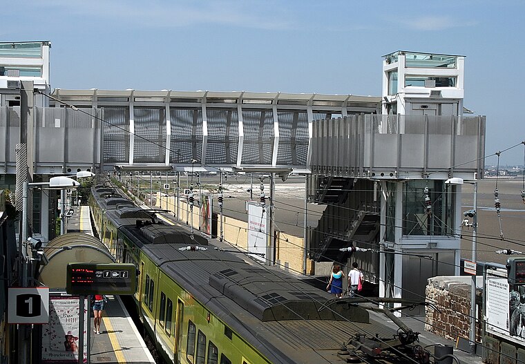
Photo: Sarah777, Public domain.
Booterstown railway station serves Booterstown in Dún Laoghaire–Rathdown, Ireland.
Sydney Parade
Railway station

Photo: TheTurfBurner, CC BY-SA 2.0.
Sydney Parade Railway Station is located on Sydney Parade Avenue in Dublin 4, Ireland.
Localities in the Area

Blackrock
Town
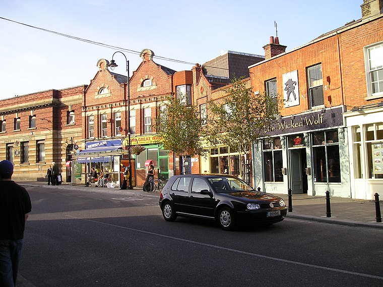
Photo: Wikimedia, Public domain.
Blackrock is a suburb of Dublin, Ireland, 3 km northwest of Dún Laoghaire.
Sandymount
Suburb

Photo: Doug Lee, CC BY-SA 2.0.
Sandymount is a coastal suburb in the Dublin 4 district on the Southside of Dublin in Ireland.
Booterstown
- Type: Suburb with 7,140 residents
- Description: human settlement
- Categories: human settlement and locality
- Location: Dún Laoghaire–Rathdown, Leinster, Ireland, Britain and Ireland, Europe
- View on OpenStreetMap
Latitude
53.3086° or 53° 18' 31" northLongitude
-6.1967° or 6° 11' 48" westPopulation
7,140Elevation
26 metres (85 feet)Open Location Code
9C5M8R53+F8OpenStreetMap ID
node 52243243OpenStreetMap Feature
place=suburbGeoNames ID
6691006Wikidata ID
Q893125Booterstown Satellite Map
© OpenStreetMap, Mapbox and Maxar
Also Known As
- Basque: Booterstown
- Cebuano: Booterstown
- Chinese: 布特斯鎮
- Dutch: Booterstown
- French: Booterstown
- German: Booterstown
- Irish: Baile an Bhóthair, Áth Cliath
- Irish: Baile an Bhóthair
- Italian: Booterstown
- Persian: بوترستاون
- Portuguese: Booterstown
- Russian: Бутерстаун
- Scottish Gaelic: Baile an Bhóthair, Áth Cliath
- Scottish Gaelic: Baile an Bhóthair
- Swedish: Booterstown
- Urdu: بوٹرسٹاؤن
Other Places Named Booterstown
Localities in the Area
- Merrion GatesLocality
- MerrionSuburb
- Cook LakeLocality
- Mount MerrionSuburb
- StillorganSuburb
Escape to a Random Place
Explore your world with these selected destinations of excellence.
About Mapcarta. Thanks to Mapbox for providing amazing maps. Data © OpenStreetMap contributors and available under the Open Database License. Text is available under the CC BY-SA 4.0 license, excluding photos, directions and the map. Description text is based on the Wikivoyage page Booterstown. Photo: Beta, Public domain.