

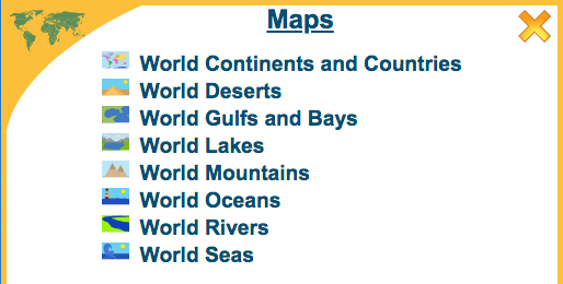
The Wordsmyth Illustrated Learner’s Dictionary contains, as one of its numerous Collections, an exceptionally important collection called, very simply, “Maps.”
First and foremost, the Maps Collection contains an interactive world map featuring all of the world’s oceans, continents, and countries. In addition, there are seven other world maps that display important geographical features of our planet, such as its major mountain ranges, deserts, rivers, lakes, and seas. All geographical place names in Maps—from Antarctica to Zimbabwe—are linked with informative definitions in the WILD dictionary Book.
The top level of the “World Continents and Countries” map labels the oceans of the world and the continents according to the seven-continent model of the earth’s geography. Mousing over a continent will highlight that continent and bring up three icons: the audio icon, the Book entry icon, and a navigational icon that looks like an airplane. The audio icon links to the pronunciation of the continent’s name. The entry icon can be clicked on to see the continent’s entry in the Book, and clicking on the navigational icon opens the map of the continent and reveals the countries that make it up. (Clicking on the continent map itself also opens up the countries map.)
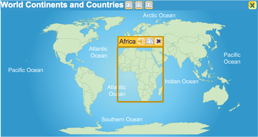
Some continents, such as Asia, Africa, and Europe, break down into regions as well as countries—regions such as Southeast Asia, the Middle East, Central Africa, and Western Europe. Clicking on a regional map brings up the countries that make up that region. In addition, clicking on the country of Canada or the United States allows navigation down to the province or state level.
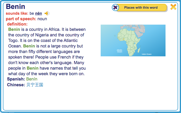
When a child clicks on the map of an individual country, or on its entry icon, or on its listing in the sidebar, he or she is presented with the country’s entry in the WILD Book, that part of WILD that is most like a conventional dictionary. Here, the child can view a closer image of the country’s shape and location (by expanding the entry’s map image) and can access other information that will give him or her an impression of what the country is like. Though our dictionary definitions are not intended to be encyclopedic in length or scope, they include such information as what type of climate or terrain characterizes the nation, what its neighboring countries are, what animals may live in the country, how people make their living there, or what languages are spoken. Any type of interesting fact about a nation may be included so that children will be encouraged to see every country of the world as unique and significant.
Getting back to the Maps from a Book entry is as simple as clicking away from the entry or clicking the close box. Once back on the countries map, the child can click around to learn more about other countries and regions of the continent. Clicking the continent’s close box brings the child back to the top level of the world map and gives access to the maps of the other continents.
The WILD interactive world maps and their connected dictionary entries in the WILD Book help children discover the world—help them discover and understand its geography, its nations, and its people. Our interactive maps make exploring and learning about the world easy and enjoyable.