


This pattern is exhausting.
After a busy week in the weather lab we're not out of the woods just yet as another complicated forecast looks to take shape heading into the weekend.
There's still a bit of uncertainty surrounding the extent of potential severe storms for Friday which will all depend on how quickly the atmosphere can prime itself for a third round of storms.
Since there's question marks surrounding the day's weather it will be important to keep an eye on current conditions and mind the radar through the day.
As of early Friday morning the Storm Prediction Center locked in for a "Slight Risk" once again.
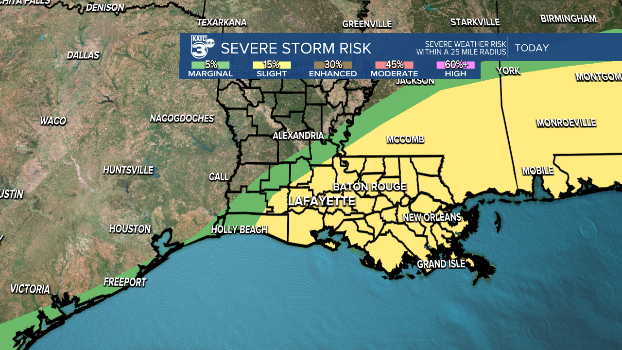
It does look like the worst of the weather will likely be just to our east with the strongest severe dynamics building in eastern Louisiana and coastal Mississippi through the day.
Complicating things is a stable layer that has taken over in the wake of Thursday night's storms.
That stable layer will start to be eaten away by another warm, muggy air mass and severe weather ingredients will start to pile up again headed into the evening and late night hours.
Models are currently indicating that this will take place mostly in the afternoon and on the eastern fringe of Acadiana, although certainly too close to take us out of the threat area.
Showers will likely fire up again late Friday night into early Saturday morning with some strong storms possible, once again wind, hail, and isolated tornadoes would be the main threats.
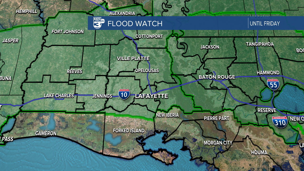
The Flood Watch will linger into Saturday morning with the potential for more heavy rains overnight, and the flooding risk may even shift south slightly.
A few areas could pick up an additional 1-2" headed into Saturday which would arrive fairly quickly making it tricky for roads to clear and drain.
Unfortunately the forecast over the next 24 hours isn't as straight forward as the last few days so it will require a little more diligence in monitoring through the day, and you'll need to be prepared for updates.
The good news is that once we get through Saturday morning's round of rain we are done, seemingly with the spring severe weather season.
A quick glance at the extended forecast tells you this is springs final crescendo and summer gets here on Sunday.
