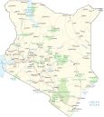
Map of Kenya – Cities and Parks

This map of Kenya contains cities, towns, highways, lakes, and rivers. Satellite imagery and a topographic map to view its savannas, lakes, Great Rift Valley, and mountain highlands.
Kenya map collection
You are free to use our Kenya map for educational and commercial uses. Attribution is required. How to attribute?
About the map
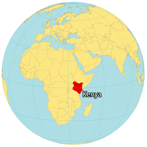
Kenya is an African country located on the eastern coastline of the Indian Ocean. It lies on the equator between 5°N and 5°S latitudes.
Kenya borders Tanzania to the south, Uganda to the west, South Sudan to the northwest, Ethiopia to the north, and Somalia to the northeast.
Nairobi is the capital and largest city of Kenya. Other major cities are Mombasa, Nakuru, and Eldoret. Overall, the country is known for its picturesque landscapes, savannas, wildebeest migration, Lakelands, and Great Rift Valley.
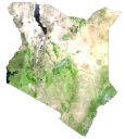
SATELLITE IMAGERY
Kenya Satellite Map
Kenya occupies an area of 580,367 square kilometers (224,081 sq mi), which makes it almost identical in size to Botswana. Its most recognized lake is Lake Victoria, which forms a border with both Uganda and Tanzania. Several geographic features distinguish key regions in Kenya.
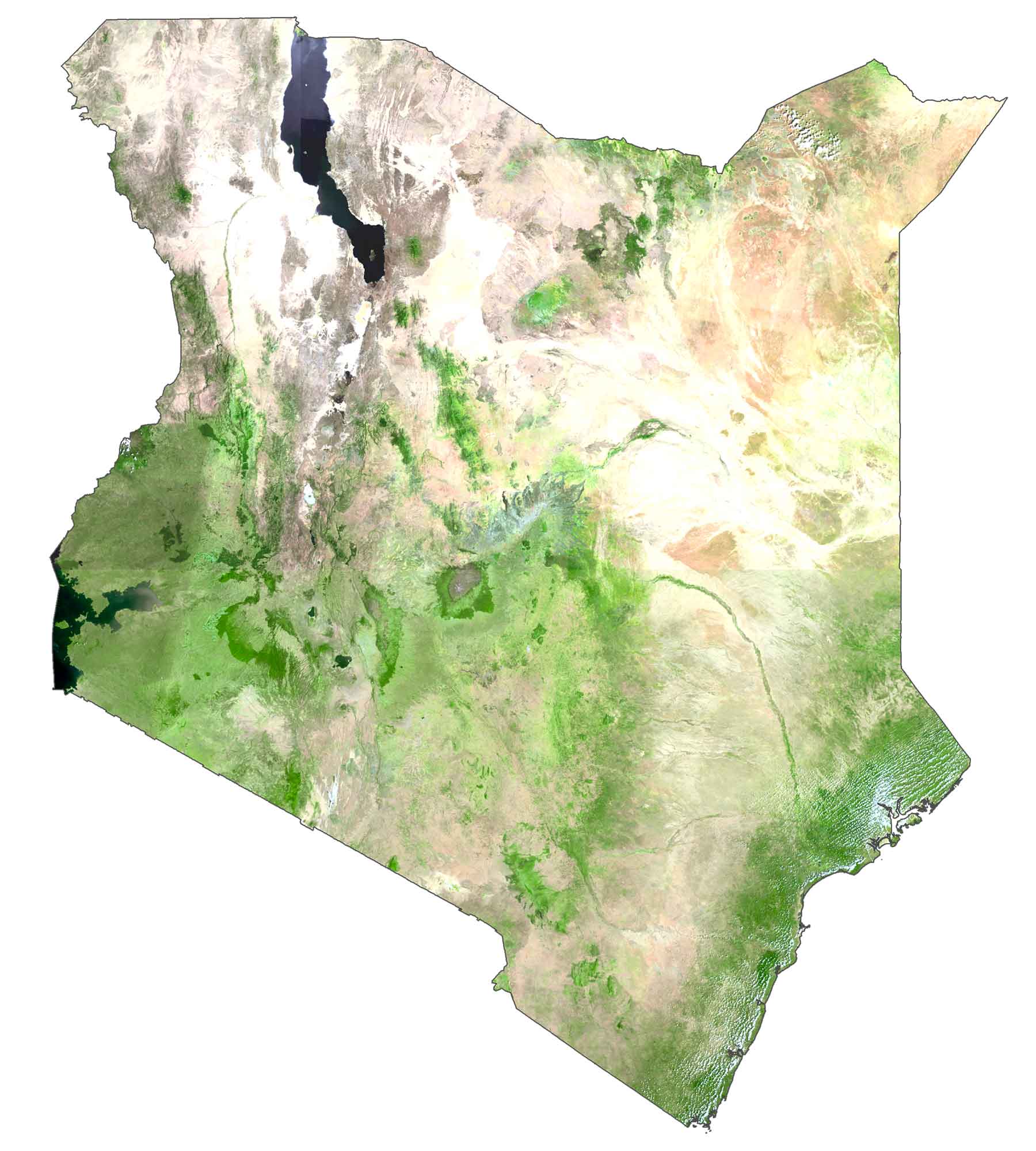
First, the Great Rift Valley cuts through Kenya in a north-south direction, forming the Cherangani Hills and a chain of active volcanoes. Secondly, the Serengeti Plains in the southwest consists of treeless grassland, which also occupies the north of Tanzania. Finally, the Chalbi Desert is a small desert located in the north near Ethiopia.
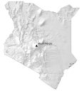
PHYSICAL MAP
Kenya Elevation Map
The physical geography of Kenya ranges from rugged mountains to savanna and Lakelands. Its most prominent mountain chain is the Aberdare Range. This 160-kilometer (100 mi) long mountain range is north of Kenya’s capital Nairobi.
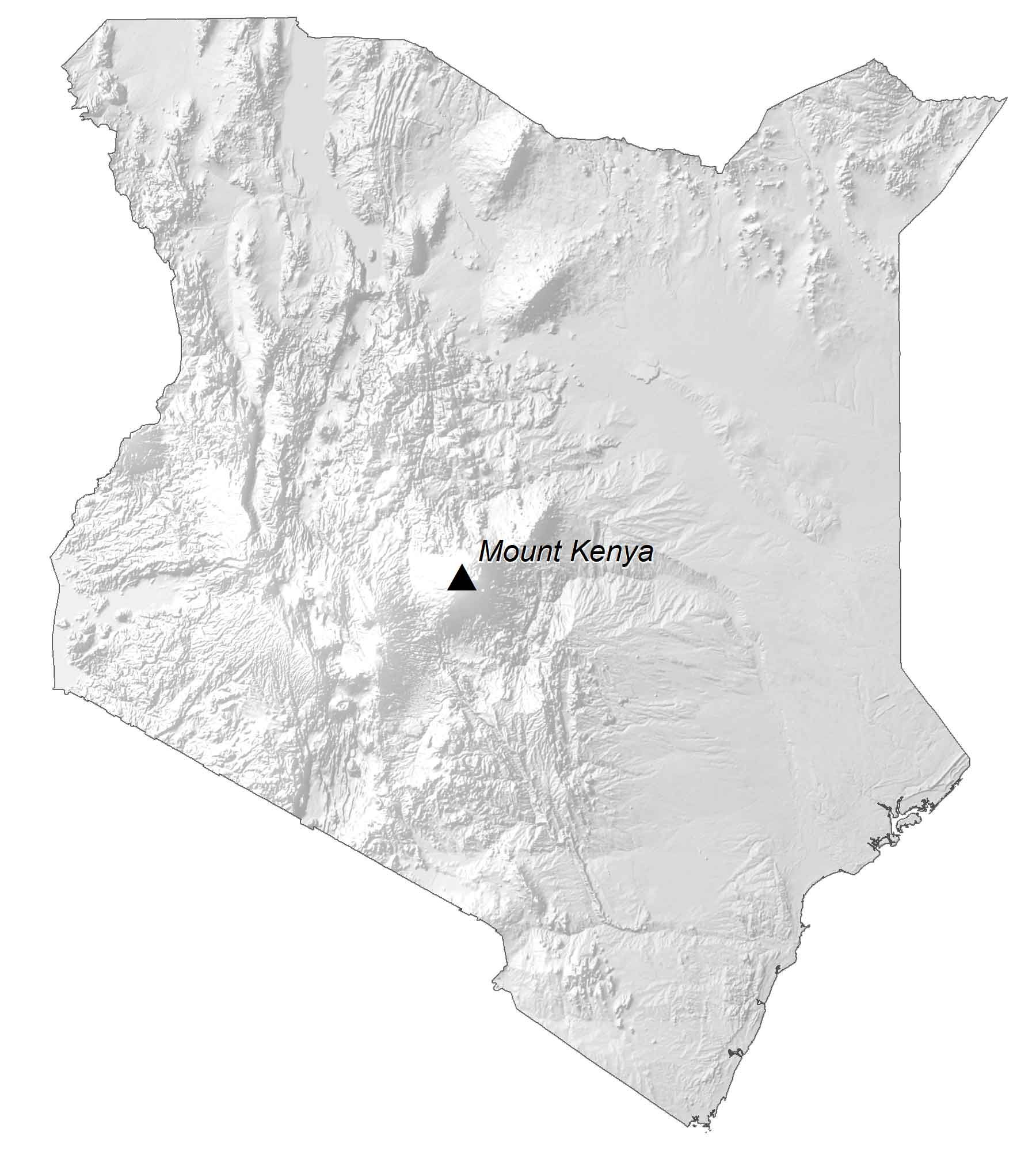
Otherwise, the Taita Hills, located in the southeast near Tanzania, contains three separate groups of mountains. While Mount Kenya is the highest peak at 5,199 m (17,057 ft), Kenya also offers views of Tanzania’s Mt. Kilimanjaro.
Capital City
Nairobi
Major cities and towns
Eldoret
Garissa
Kakamega
Kisumu
Mombasa
Nakuru
Thika
Cities, towns and villages
Buna
Butere
Embu
Gilgil
Habaswein
Hola
Homabay
Kagio
Kakuma
Kajiado
Kibwezi
Kericho
Kitale
Kolbio
Liboi
Lodwar
Lokichar
Lokichokio
Londiani
Machakos
Malakisi
Malindi
Mandera
Mariakanii
Marigat
Marsabit
Meru
Migori
Moyale
Murang’a
Naivasha
Narok
Nyahururu
Nyeri
Olsiolo
Post
Ramu
Solai
Sultan-Hamud
Taveta
Thomson’s Falls
Todenyang
Wajir
Webuye
Lakes, rivers and creeks
Ewaso Ng’iro River
Galana River
Indian Ocean
Laga Bor River
Lak Dera River
Lake Amboseli
Lake Turkana
Lake Victoria
Lake Baringo
Lake Magadi
Lake Naivasha
Lake Turkana
Suam River
Tana River
Tsavo River
Turkwel River
Ungama Bay
National parks and reserves
Aberdares National Park
Amboseli National Park
Bisanadi National Reserve
Boni National Reserve
Central Island National Park
Dodori National Reserve
Kora National Reserve
Losai National Reserve
Maralal Game Sanctuary
Marsabit National Park
Masai Mara National Reserve
Meru National Park
Mount Elgon National Park
North Kitui National Reserve
Rahole National Reserve
Shaba National Reserve
Shimba Hills National Park
South Island National Park
South Turkana National Reserve
Tsavo East National Park
Tsavo West National Park
Islands
Central Island
Lamu Island
Manda Island
Pate Island
Mfangano Island
Mountains
Mount Kenya