The first thing that hits me is the stench of something rotten—or more likely rotting—beneath my feet. The second is the sound of my shoes squelching in the soft mud as I try to take another step. No luck. I’m up to my shins in the thick, smelly muck of a tidal salt marsh.
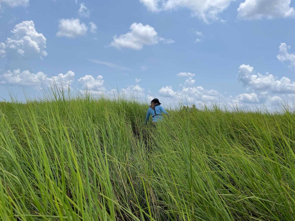
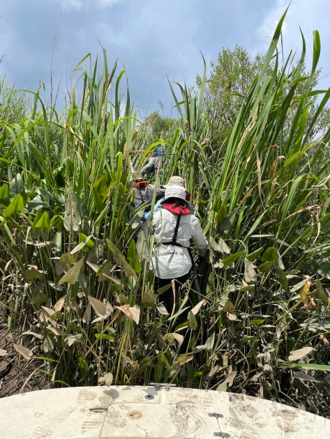
The team of scientists I’ve been trailing—led by University of Houston biologist Steve Pennings—is now far ahead of me rustling through the waist-high grasses on this tiny island near the mouth of Georgia’s mighty Altamaha River.
Christi Lambert, TNC’s director of coastal conservation in Georgia, stands similarly sunk. “Maybe we should head back,” I suggest. She agrees. We unstick ourselves and return to the boat, stepping gingerly over a pile of jagged oyster shells that line the embankment. When the rest of the team returns—a clipboard of new data in hand—they are coated in black mud.
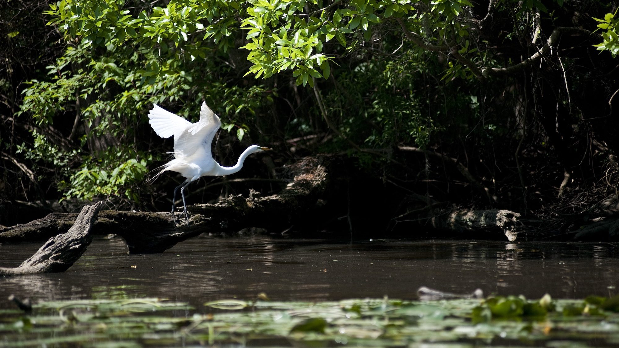
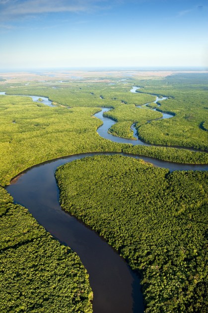
It’s the first year of what could become a decade-long experiment to better understand the life-sustaining marshes here on the Georgia coast. Not only do these marshes protect lands upstream from storm surges, their dense root systems trap sediment and, over time, store carbon, Lambert tells me. They’re lively too: They provide nursery habitat for young fish and crabs and feeding sites for many birds like herons. And the marshes themselves migrate.
Pennings and his research assistants are trying to answer fundamental questions about how this landscape functions and how quickly different types of damaged marshland can recover when things like sea level rise, storm surges and washed-up debris damage species or alter the salinity of the soils.
The research is part of the Long-Term Ecological Research Network—a collection of more than two dozen sites where the National Science Foundation has funded long-term or large-scale studies that often examine the way ecosystems function. While most ecological studies are funded for short periods of time, the network, launched in 1980, set out to fund long-term research in an effort to understand ecological phenomena. One of the sites is located at the Virginia Coast Reserve, where TNC has helped protect eelgrass for decades.
In Georgia two of the LTER monitoring sites are located on TNC-owned land, a few more on state-owned land. Over the last few decades, TNC, the Georgia Department of Natural Resources, U.S. Fish and Wildlife, the U.S. Department of Defense and private landowners have collectively protected about 220,000 contiguous acres around the lower Altamaha River. Early modeling from the Georgia LTER helped inform some of those conservation decisions, Lambert says. “Looking at what are these habitats going to look like in the future,” she says, “that helped us when we were considering lands to acquire and where to focus land protection.”
Now the current LTER work, under Pennings, the field director, and Merryl Alber, the office’s project director and a University of Georgia professor, stands to do the same.
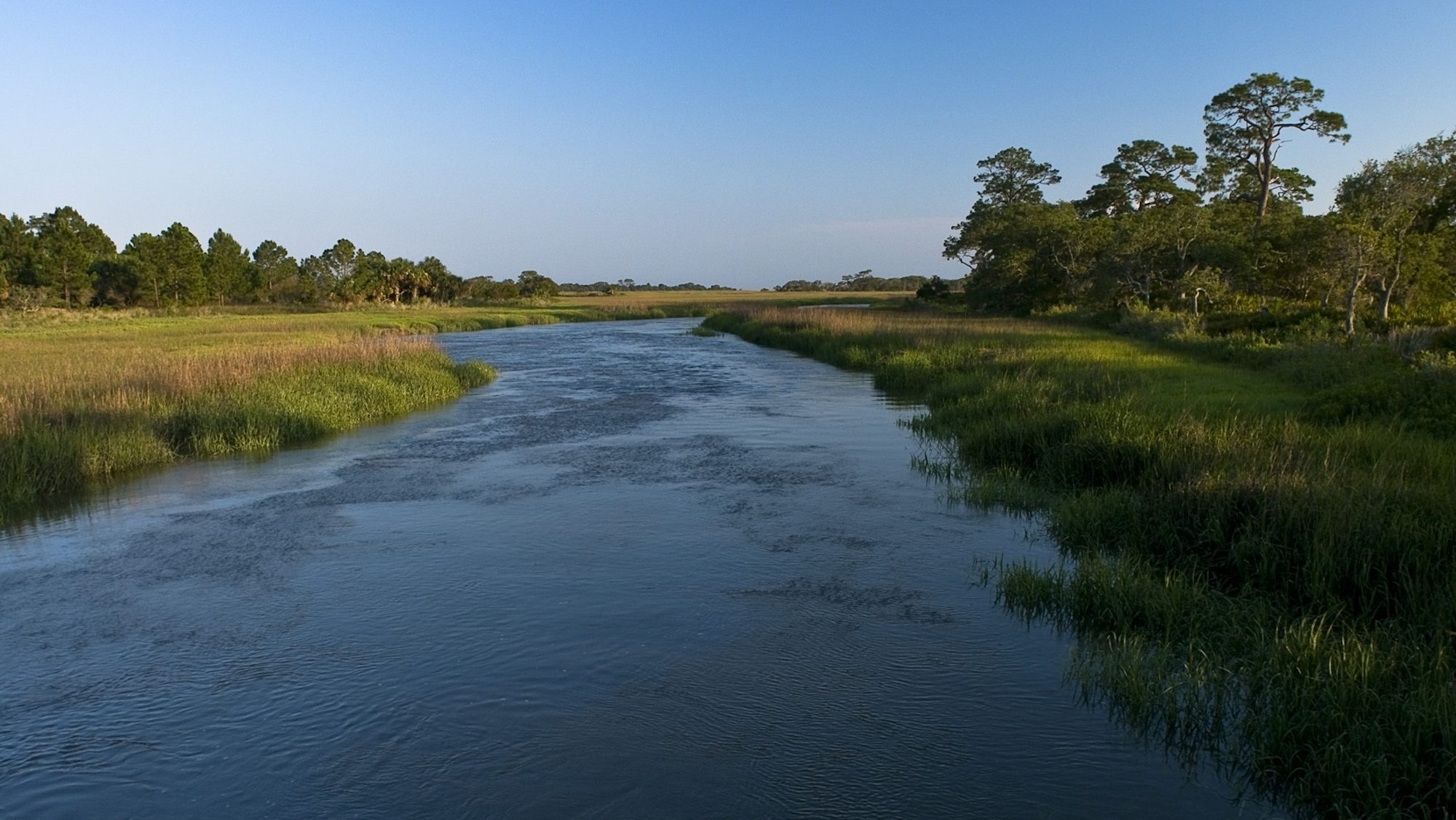
From the mouth of the Altamaha, we speed up the river to check in on the next few research plots, passing through the different tidal zones: Green salt marsh grasses give way to brackish areas and then tidal freshwater marsh habitat. Lambert gestures at the trees now visible along the shorelines. “The river can stretch 5 miles wide at times,” she says. “It really gives meaning to ‘floodplain forests.’”
At a later stop, the ground is more solid, and I follow the researchers to a tidal freshwater marsh plot— a square of mud and grass less than two feet wide demarcated by four pieces of PVC pipe placed on the ground. The grasses here—edges sharp enough to slice through skin—reach at least 3 feet over my head. The research assistants catalog information about the plants, animals, soil and environment. “Nine fiddlers. Zero snails,” calls out one. “Soil strength 2,” calls out another.
Then, they turn to a nearby patch of flattened-down, dead-looking grass—a plot of intentionally damaged marsh. The researchers are examining the brown grass for signs of life and resurgence, comparing it to the undisturbed square a few feet away.
“We’re doing the experiment across the salinity gradient of the estuary,” Pennings told me earlier. Twin plots like these are spread out across four vegetation types up the river. They’re testing how resilient the marsh is in different environments.
“We’re creating a roadmap for how different kinds of tidal systems recover and how often they’re disturbed,” Pennings says.
When this work began here two decades ago, Pennings tells me, researchers were more focused on salt marsh than on tidal freshwater areas. “We had one brackish marsh site, one tidal freshwater site,” he says. “Other than that, everyone was really focused on salt marsh.”
Now the tides have turned, so to speak, and inland work has grown driven in part because upstream areas tend to have more human impacts—tilled and developed areas, for example—but also because of a growing realization that climate will alter these habitats.
As sea levels rise, saltwater is expected to move upstream, and that change in salinity will convert brackish and freshwater areas into saltwater habitats. In addition to this “disturbance” study Pennings is showing me, researchers have set up monitoring plots to study these changes. Located on the edges of vegetation types, these plots will capture snapshots of the marsh migrating inland—snapshots of global change in a few square feet of grass.
It has me thinking as we head back to the boat, the saying is true: the only constant here is change. The water around us is brown with silt—the product of miles of erosion, plant life and soil washed down from the piedmont and the mountains. It builds up the tiny islands at the mouth of the river, where marsh grasses, debris and aquatic life break down into the mud I’d sunken into that morning. The ocean tides in turn push saltwater up the river, washing debris over the marshes themselves. But if Pennings and the other researchers can learn how quickly the marsh changes—and how resilient it can be—perhaps Lambert and others can help protect it as it evolves.
A version of this article ran in Nature Conservancy magazine’s latest issue. Read other stories from Issue 2, 2024 here.

Join the Discussion