Monday I went on a bike ride. I wanted to check out a new (to me) bike trail Bixby put in.

The new trail section didn’t have a trailhead with parking or anything. It starts at a neighborhood entrance with no parking anything so I went into the neighborhood and parked at their association play park and swimming pool just so I wouldn’t be in anybody’s way.

So I rode 15 miles on Bixby’s bike trail system. It’s oriented three segments: northeast, northwest and southern. The new leg is the northeast segment. I started at the very northern end and moved over to the northwest and then backtracked down to do the southern segment. I’ve been on the northwest and southern segments several times before.

The northeast segment cuts in behind a subdivsion and a grass farm. Bixby grows a lot of grass sod. There is less of it all the time because the farmers are selling out to builders who are building lots of subdivisions.

The bike path goes close to several strip shopping centers.

Much of it is in big spacious green belts bordering creeks and drainage ditches.

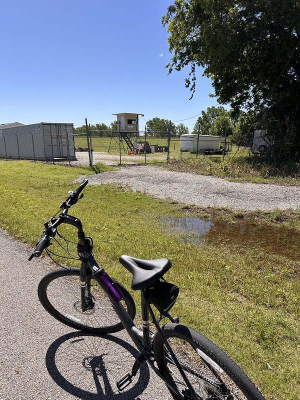
Here is the very northern end of the northwest leg. Somebody had mowed a path through the grass so I had to go check it out.

It looks like a homeowner put a gate in on his back fence and uses his mown path to access the trail. I’m hoping that Bixby and Tulsa get together and connect Bixby’s trail system with Tulsa extensive system. They only have two miles to go.

The southern leg goes in back of Joe’s Farm. The last truck farm in Bixby. It’s an amazing place and they do a great business.
The southern leg goes by the Bixby Police Department gun range. I’ve been by when they are shooting with their AR15 type rifles. They are not loud. They make an airy pew, pew, pew sound.
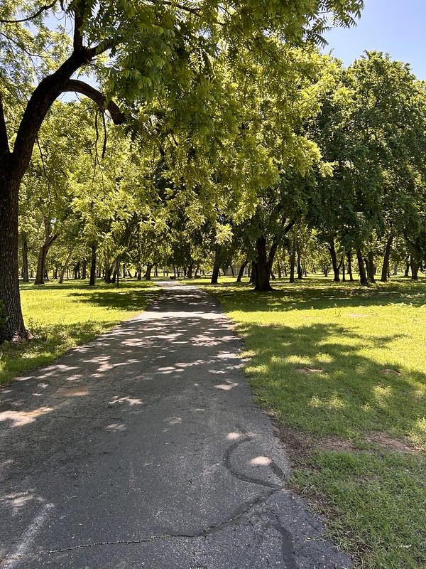
And then we are into Washington Irving Park.

I revisited Mr. Irving. He camped overnight here on October 12, 1832 during his tour of Oklahoma accompanied by U.S. Rangers back then. He wrote “A Tour on the Prairies” about his travels.
We have had rain so the river is up but not near flooding.
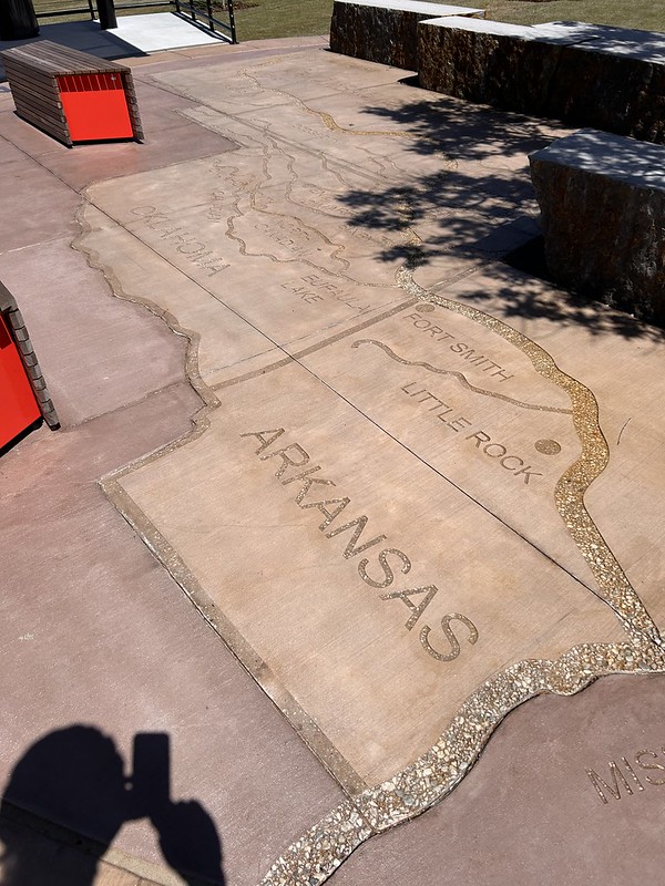
There is a map of the Arkansas River set in concrete. It is a really long river. It originates in the Rocky Mountains near Leadville, Colorado which is only 85 miles from where my sister lives in Colorado Springs.

The old bridge across the Arkansas is now a pedestrian bridge called the Harmony Bridge. A fun area with seating, shade, and entertaining things for kids and childish adults, like me, to do.
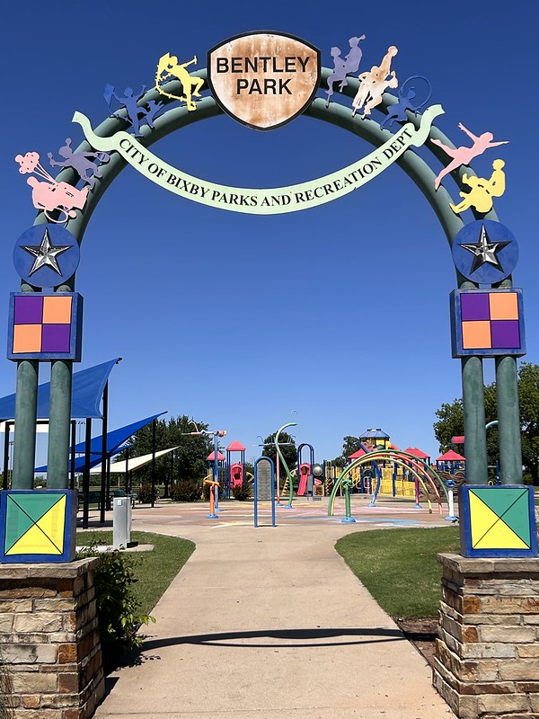
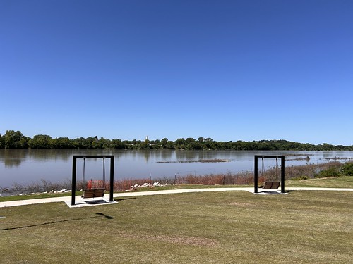
And the turn around is this cool play park.
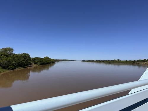
And doubling back to the car, this was my only stop. On Harmony Bridge looking upriver.
So that was my fun little adventure.
I am linking with Skywatch Friday.
Quite a ride. Wife’s mother was from Leadville, she still has cousins that live there. With my grandparents we used to drive to Salida and watch the kayak racing down to Cotopaxi. Lived in Pueblo before moving south and the river runs through town.
I love how you stop to take photos on your adventures. It’s always good to smell the roses along the way. You’re lucky you live in a city with so many outdoor recreation opportunities.
…you where able to enjoy some nice bike paths.
15 miles, that sounds like a good bike ride to me!
I enjoyed the scenery along the way.
Nice views of the river and bridge and the sculpture!
Take care, enjoy your day and have a great weekend!
I’m always happy when they add bike trails. The park is beautiful. I enjoyed your trip. Thanks for taking me along.