Alservorstadt, Vienna
Map
Facts and practical information
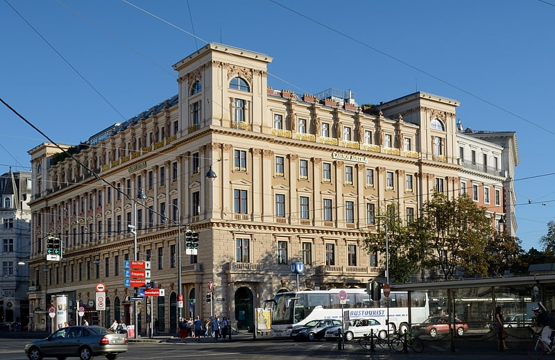
Alservorstadt was an independent municipality until 1850 and is since then divided between Josefstadt and Alsergrund, the 8th and 9th districts of Vienna, respectively. ()
Address
Alsergrund (Alservorstadt)Vienna
ContactAdd
Social media
Add
Getting there by public transportation
Public transportation stops near this location
- Metro
- Bus
- Tram
- Light rail
- Train
- Ferry
 Metro
Metro
- Calculate routeLandesgerichtsstraße 5 min walk
- Calculate routeLange Gasse 5 min walk
- Calculate routeSchwarzspanierstraße 7 min walk
- Calculate routeAlser Straße, Skodagasse 7 min walk
- Calculate routeLandesgerichtsstraße 5 min walk
- Calculate routeLange Gasse 5 min walk
- Calculate routeLazarettgasse 6 min walk
- Calculate routeSchwarzspanierstraße 7 min walk
- Calculate routeSchottentor 11 min walk
- Calculate routeAlser Straße 15 min walk
- Calculate routeMichelbeuern-AKH 15 min walk
- Calculate routeHerrengasse 18 min walk
- Calculate routeWien Franz-Josefs-Bahnhof 21 min walk
- Calculate routeWien Gersthof 40 min walk
- Calculate routeNationalparkboot Lobau 23 min walk
- Calculate routeOper, Karlsplatz 31 min walk
- Calculate routeKarlsplatz 33 min walk
Day trips


Frequently Asked Questions (FAQ)
Which popular attractions are close to Alservorstadt?
Nearby attractions include Department of Contemporary History of the University of Vienna, Vienna (2 min walk), Billrothhaus, Vienna (3 min walk), Narrenturm, Vienna (5 min walk), Votivkirche, Vienna (6 min walk).
How to get to Alservorstadt by public transport?
The nearest stations to Alservorstadt:
Bus
Tram
Metro
Train
Ferry
Light rail
Bus
- Landesgerichtsstraße • Lines: N43 (5 min walk)
- Lange Gasse • Lines: N43 (5 min walk)
Tram
- Landesgerichtsstraße • Lines: 43, 44 (5 min walk)
- Lange Gasse • Lines: 33, 43, 44, 5 (5 min walk)
Metro
- Schottentor • Lines: U2 (11 min walk)
- Alser Straße • Lines: U6 (15 min walk)
Train
- Wien Franz-Josefs-Bahnhof (21 min walk)
- Wien Gersthof (40 min walk)
Ferry
- Nationalparkboot Lobau (23 min walk)
Light rail
- Oper, Karlsplatz • Lines: 62, Wlb (31 min walk)
- Karlsplatz • Lines: 1, 62, Wlb (33 min walk)