Plan ahead: Soupy air to spark multi-day storm risk over Ontario
Have a plan to head indoors over the next couple of days as warm, soupy air fuels a repetitive risk for thunderstorms across southern Ontario
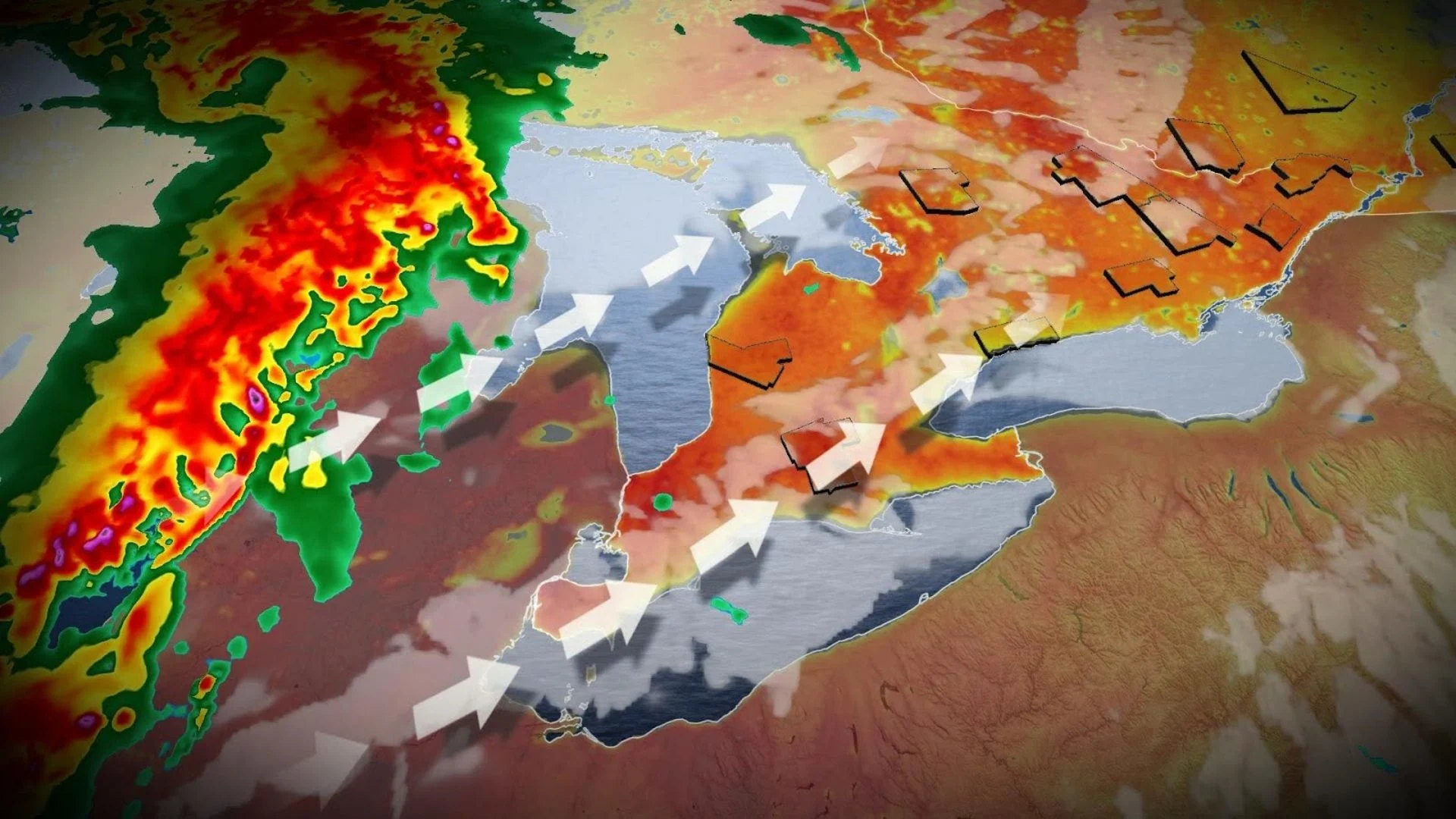
The warmth and humidity sloshing over the Great Lakes for the next couple of days will provide ample fuel for thunderstorms to develop over Ontario.
Several rounds of stormy weather are possible through the first half of the week. We’ll have to closely watch the development of thunderstorms south of the border for a severe weather threat by Wednesday.
DON’T MISS: Stuck in your car during a tornado? Here’s what you should do
Catch your day-by-day breakdown of the storm risk across southern Ontario, below.
The stormy setup
We’re firmly in storm season across the eastern half of the country as teases of summer begin working north of the border.

A warm, humid air mass parked over Ontario this week will send temperatures into the upper 20s, with plenty of towns pushing the 30-degree mark for the first time this season. Humidex values will push well into the 30s, especially across the southwest and away from the lakes.
All that instability needs is a trigger to kick off showers and thunderstorms. We’ll have plenty of sparks over the next couple of days to get scattered storms going with the heat of the day.
Warm front focuses Monday’s storm risk
A warm front nosing into southern Ontario on Monday will serve as the focus for thunderstorm activity through the afternoon and nighttime hours.
The greatest instability across southern Ontario will be found north of Highway 401, which could fuel scattered thunderstorms. Dynamics don’t support much in the way of a severe weather threat, but locally heavy rainfall is likely given the amount of moisture in the atmosphere.

DON’T MISS: Safety tips to avoid a lightning strike during a thunderstorm
Monday’s threat includes Sarnia, London, Barrie, and Sudbury. We could also see a stray storm sneak into northern and western portions of the Greater Toronto Area.
Any of the stronger storms that pop up on Monday could produce heavy rainfall, small hail, and gusty winds.
There is some uncertainty in the extent of Monday’s storm threat given the potential for cloud cover throughout the day. Decaying storms on the U.S. side of the border will send clouds into southern Ontario, which may limit the storm potential for some areas.

Remember that even a ‘non-severe’ thunderstorm is still dangerous. Lightning is the greatest threat posed by any thunderstorm. Stay close to safe shelter if you’re planning to spend time outdoors. If you’re close enough to hear thunder, you’re close enough to be struck by lightning.
Storms expected to continue overnight Monday
Thunderstorms that bubble up along the warm front over southern Ontario will likely continue into the overnight hours through pre-dawn Tuesday morning.
These storms are expected to arch across southern Ontario while largely missing the Greater Toronto Area.
We’ll see the risk for thunderstorms move into eastern Ontario early Tuesday morning as a cluster of storms makes its way east into the region.
Renewed storms expected on Tuesday
Tuesday will see another round of thunderstorms develop with the heat of the day across southern Ontario as that front shifts southeast across the region.
It’s likely this southeastward shift will put the Greater Toronto Area squarely within the risk for thunderstorms through the day Tuesday.

As we saw with Monday, torrential downpours will be the greatest risk given the amount of moisture storms will be able to tap into.
Another warm front lifting north across the GTA on Tuesday night could serve as the trigger for an additional round of nocturnal thunder over the region.
Wednesday’s risk depends on stateside storms
A strong low-pressure system developing over the U.S. Midwest will dictate Wednesday’s storm threat.
Forecasters south of the border expect a potent severe weather event to unfold across the Midwestern states during the day Tuesday.
These storms could include supercells and squall lines capable of producing tornadoes and widespread damaging winds, threatening the major travel hubs of Chicago and Kansas City.
MUST SEE: How severe weather alerts are issued, and potentially save lives

These storms will push east through the evening and nighttime hours, potentially threatening portions of southern Ontario on Wednesday. Temperatures in the upper 20s with high humidex values will support the risk for severe thunderstorms across all of southern Ontario.
The timing of the cold front’s passage, as well as lingering storm activity from Wednesday morning, will dictate the severe thunderstorm potential across the region. Forecasters will closely watch how this setup develops to assess any potential impacts to southern Ontario.
It’s always a good idea to have a safety plan in place for severe weather. Make sure you have a way to receive severe weather warnings the moment they’re issued, especially at night.
Temperatures and humidity levels will both tumble behind the cold front, allowing more seasonable air to spill over the region heading into the end of the week.
Stay with The Weather Network for all the latest on your forecast across Ontario.