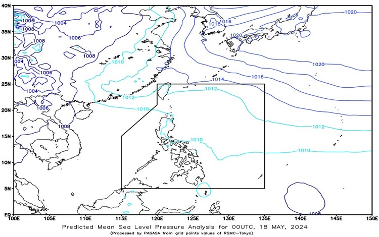
SYNOPSIS: A shear line is currently affecting Extreme Northern Luzon, while easterlies are influencing the weather conditions across the rest of the Philippines.
Forecast Weather Conditions
Area: Batanes and Babuyan Islands
- Weather Condition: The regions of Batanes and Babuyan Islands will experience cloudy skies accompanied by scattered rain showers and thunderstorms.
- Caused By: This weather pattern is due to the shear line affecting Extreme Northern Luzon.
- Impacts: Residents in these areas should be prepared for possible flash floods or landslides, as moderate to occasionally heavy rains are expected.
Area: Metro Manila and the Rest of the Country
- Weather Condition: For Metro Manila and the rest of the country, the forecast predicts partly cloudy to cloudy skies with isolated rain showers or thunderstorms.
- Caused By: These conditions are primarily driven by easterlies.
- Impacts: Despite the generally fair weather, isolated thunderstorms may occur, which can lead to sudden heavy rainfall. This poses a risk of flash floods or landslides, especially in areas prone to such events.
Forecast Wind and Coastal Water Conditions
The entire country is advised to monitor the wind and coastal water conditions, as varying wind speeds and wave heights can impact local activities, particularly for coastal and maritime operations.
General Flood Advisory
A general flood advisory has been issued at 6 AM on May 18, 2024, particularly highlighting the Cordillera Administrative Region (CAR). The advisory, labeled GFA#8, serves as a precautionary measure due to the increased likelihood of flooding in this mountainous area, which can be exacerbated by the ongoing weather conditions.
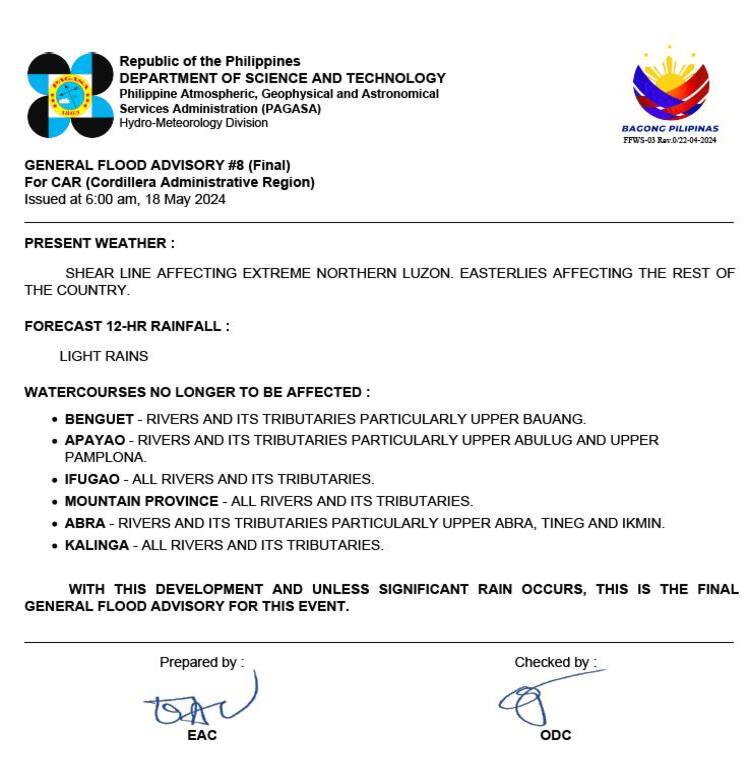
Detailed Advisory for CAR (Cordillera Administrative Region)
Residents and local authorities in the Cordillera Administrative Region are urged to stay alert and take necessary precautions against potential flooding. Given the region’s topography, heavy rainfall can quickly lead to river swelling and landslides. Continuous monitoring of weather updates and adhering to local advisories are crucial for ensuring safety.
Recommendations for the Public
- Stay Informed: Keep updated with the latest weather reports and advisories issued by the Philippine Atmospheric, Geophysical and Astronomical Services Administration (PAGASA).
- Prepare for Emergencies: In areas prone to flooding or landslides, ensure that emergency kits are ready and evacuation plans are in place.
- Avoid Risky Areas: During heavy rainfall or thunderstorms, avoid low-lying and mountainous regions, as well as riversides which are more susceptible to flash floods and landslides.
- Safety Measures for Mariners: For those in coastal areas, stay updated on the latest sea condition forecasts, and avoid venturing out to sea if rough conditions are expected.
By taking these precautions, residents across the affected areas can mitigate the risks posed by the current weather patterns and ensure their safety during this period of instability.