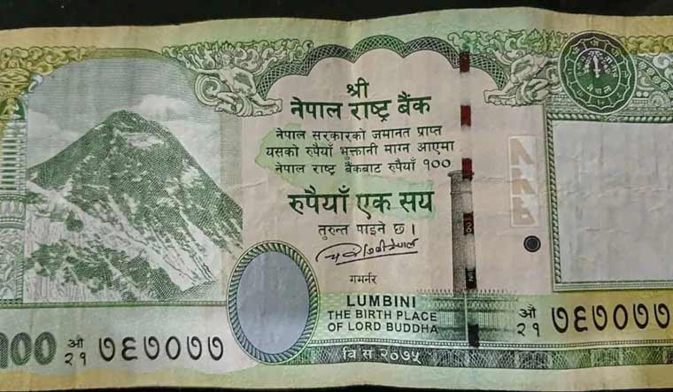
On Monday, the economic advisor to Nepal's President Ram Chandra Paudel resigned from his post. Chiranjivi Nepal's resignation came after he termed 'inappropriate' the government's decision to print the new map on the notes as ‘an inappropriate move'.
His sudden resignation suggests that even Nepal isn't willing to downplay or backtrack from its decision to claim the territories of Lipulekh, Limpiyadhura, and Kalapani as its own.
The border row was ignited a week ago when Nepal announced a new currency note featuring a map that shows Kalapani, Lipu Lekh and Limpiyadhura, which are currently under India's control. Nepal has claimed the 335 square kilometres (130 square miles) of land. India reacted to it, stating that Nepal’s unilateral actions will not change the ground reality.
But, this isn't the first time that Nepal has come out with a currency note showing the Limpiyadhura-Kalapani-Lipulekh area within its territorial boundary. On June 18, 2020, Nepal updated its new political map with these three strategic regions, which was disregarded by India, which called it an 'artificial enlargement' and 'untenable'.
Lipulekh, Kalapani and Limpiyadhura
The 370-square-kilometre strip is located at the north-western corner of the country at the trijunction between India, Nepal, and China. The land has been under Indian administration for a long time.
The territorial boundary of modern Nepal was defined by the Sugauli Treaty signed with the British East India Company in 1815. It said that the course of the Kali River ( also known as the Sharda in India) marked Nepal’s boundary on its western side while River Mechi marked its border on the eastern side. The treaty was the result of a battle between the Gorkha Kingdom and the British East India Company. The borders were not marked on a map and even if it was, it has not been found.
The Kali River has two tributaries—one starting at Lipukekh and the other at Limpiyadhura. The treaty did not specify which of these two tributaries would be considered the Kali to delineate the boundary.
While Nepal argues that the Kali begins further west in Limpiyadhura, India claims the Kali starts at Lipulekh, which lies east of the pass that Nepal claims as its own. India's claim is based on the 1879 map handed down to it during Independence.
The British East India Company shifted the boundaries to the east of Kalapani. The monarch who ruled Nepal didn’t object, and this continued after India's Independence too. In the early 1960s, King Mahendra gave consent to Indian Prime Minister Jawaharlal Nehru to continue the use of the Lipulekh-Kalapani area.
The Lipulekh Pass is one of the trading routes between India and Tibet and holds historical and cultural significance. During the Sino-Indian War, this trade route was under scrutiny as they feared that it could be used as a secret passage for incursions by Chinese troops during wartime. In 1962, Indians closed this trade route as an aftermath of the Sino-Indian war.
.jpg)
Nepal raised the issue with India in 1991 after the country shifted from a monarchy to a democratic government. The newly elected government raised objections regarding this trijunction with India, leading to the formation of a committee. Several claims were resolved, but the Limpiyadhura-Kalapani-Lipulekh region remained untouched.
Recent boundary dispute
The boundary dispute between the two countries escalated after New Delhi issued a political map in November 2019 that placed the contested area within India's territory.
Relations became more strained when India inaugurated an 80-kilometre-long roadway that passes through Lipu Lekh, a disputed area that lies at the strategic Nepal-India-China tri-border. The new road links Darchula to Pithorograh in Uttarakhand which Nepal claims as part of their region as per historical records. The Nepal government reacted to this. The road also holds strategic significance as it will provide a link to the Indian troops assigned at the Line of Actual Control.
In 2020, Nepal’s Parliament cleared a Constitution Amendment Bill that endorses the country’s new map that includes territories with India — Limpiadhura, Lipulek and Kalapani. Weeks earlier, Nepal Prime Minister K P Oli declared those areas would be brought within Nepal’s map and possession.


