

- Coastal low brewing
- Areas affected: Wollongong north past Newcastle
- It could get classic, but winds may vary
Forecasts aligned with this Incoming: Newcastle | Sydney | Wollongong
There’s something brewing along the central and southern NSW coast. It could be a late autumn classic. This is prime season for lows developing in this manner, but maybe don’t call them East Coast Lows! We’ve come close a couple of times already this autumn – the Black Nor’easter springs to mind — and this one looks like another close call. It’s not going to be the high end, crazy, swell slamming, neighbourhood flooding, windy beast that we know as an East Coast Low. It’s more of a low-end storm – a more mild mannered coastal low.
And this could be great news for us! There’s going to be a decent spike in short period east and SE swell over the weekend and into next week. There’s going to be some rain, but most of it likely going south of Wollongong. The wind north of there could very well swing nicely offshore from Sunday and stay out of the W to SW to S all the way through to Tuesday.
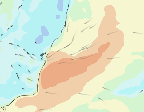
Surfline wind charts, showing the naughty little low as it forms just off Sydney overnight on Friday, bending the winds around itself…
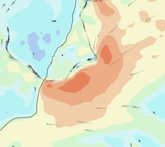
…Then shifts slightly SE as the wind intensifies, blowing onshore south of Wollongong and becoming light and variable north of there, with some pockets of light W-SW winds…
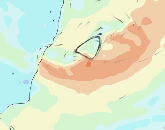
…Then steadying the offshore wind pattern north of itself along the coast, as the winds in mid-Tasman continue to push in short-range swell in the super fun size range.
We’re looking at the potential for really good surf, the beaches from Wollongong to Newcastle eat up this shorter to mid-period east swell, couple that with offshore winds and it’s something to get excited about: peaky, wedgy and clean head high plus surf for a few days.
This is not guaranteed. Little shifts in the low could scupper this forecast and we end up blasted with strong cross to onshores and more rain. It May be really good or it May be really bad!
Cams to track this wild little thing: Thirroul | Cronulla | Manly | Narrabeen | Avoca