
Hello, sign in
Shop By Department
Marine ElectronicsAutomotive GPSHeadphones & HeadsetsHome & GardenPet SuppliesSee More


Garmin GPSMAP® 22" 8622 MFD Chartplotter with LakeVü g3 & BlueChart® g3 Map
$9,714.51
Garmin GPSMAP® 22" 8622 MFD Chartplotter with LakeVü g3 & BlueChart® g3 Map
$9,714.51
Free Shipping
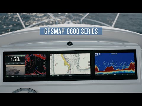
The Garmin GPSMAP 8622 chartplotter with 22" full HD screen with touch control is sunlight-readable and also includes auto dimming feature for use in low light or at night. The device provides standard USB touch output for use as a touchscreen monitor for Windows® and Mac® operating systems. Supported sailing features include lay lines, an enhanced wind rose, heading and course-over-ground lines, true wind data fields, and tide/current/time slider. Racing features include pre-race guidance, synchronized race timer, virtual starting line, time to burn and layline data fields. Gauge displays show true and apparent wind angle, set and drift, true or apparent wind speed, horizontal or vertical graphs.
The GPSMAP 8622 features 10 Hz GPS receiver that refreshes position and heading 10 times per second. The device supports GSD™ 26 CHIRP professional sonar, GSD 24 advanced sonar, and GCV™ 10 or GSD 25 DownVü and SideVü scanning sonar, and is fully network capable for NMEA 0183 and NMEA 2000®. The device is waterproof and has an external Antenna.
- Chartplotter GPS Navigation
- WiFi
- Resolution: 1920 x 1080
- Waypoints / Routes : 5000 / 100
- CHIRP Sonar Technology
- Dual-Frequency (50/200 kHz) Sonar Capable
- Dual-Beam (77/200 kHz) Sonar Capable
- Supports AIS
- Supports DSC
- Supports FUSION-Link™ Entertainment System
- Supports GSD™ & GCV™ Scanning Sonar Module
- NMEA2000 Compatible
- NMEA 0183 Compatible
- 10Hz GPS Internal Receiver
- Full HD Display
- Dual SD Data Card Slots
- 22" Display
- Flat or Flush Mounting
- BlueChart® g2 US Coastal Charts & LakeVü™ HD US Lakes
- External Antenna
- Touchscreen IPS Display (Anti-Glare Finish)
- Track Log: 50000 Points, 50 Saved Tracks
- Voltage: 10VDC
- Connections:
- - USB
- - HDMI
- - BNC Connector
- - NMEA 0183 4 Input / 2 Output Ports
- - NMEA2000
- - 4x Garmin Marine Network™ Ports
- - J1939 Port
- Operating System Compatibility:
- - Mac
- - Windows
- Wireless Connectivity
- Resistance:
- - IPX7 Waterproof
- Tide Tables
- Garmin Radar Compatible
- BlueChart® Mobile (planning) Compatible
- Garmin Helm Compatible
- GRID™(Garmin Remote Input Device) Compatible
- Garmin SmartMode Compatible
- Garmin Meteor Audio System Compatible
- SiriusXM™ Weather & Radio compatible
View All Specifications
What's in the box?
View Accessories
View Compatible Devices
View Documents

Warranty

1 Year Warranty
Condition
New
Product Options:
Garmin GPSMAP® 22" 8622 MFD Chartplotter with LakeVü g3 & BlueChart® g3 Map
$9,714.51

with Garmin Panoptix™ LiveScope™ Sonar System - Transom Mount
$10,009.99
Now $9,714.51
Starting at $405/mo or 0% APR with Affirm

30-Day Returns

New Vs Refurb

Free Shipping
In the Box
1
X
Includes :
- GPSMAP 8622
- Trim piece snap covers
- GPS 24xd NMEA 2000 (with pole mount, flush mount and underdeck mount adapters)
- Protective cover
- Flush mount hardware
- Power cable
- NMEA 2000 2 m backbone/drop cable
- NMEA 2000 6 m backbone cable
- NMEA 2000 power cable
- NMEA 2000 T-connector & terminator kit
- Documentation
Accessories
Bundle & SAVE Up To 25%
Bundle Price:$9,714.51
Compatible Devices
Bundle & SAVE Up To 25%
Bundle Price:$9,714.51
Documents
The Garmin GPSMAP 8622 has many exciting features for users of all types. It's one of FactoryOutletStore's best selling Marine With Inland Charts
. You can extend the lifetime of your Garmin GPSMAP 8622 with the purchase of a FactoryOutletStore Factory Protection Plan. See the Garmin GPSMAP 8622 product video and gallery images above for more details. FactoryOutletStore stocks a full line of accessories like 20' Marine Network Cable, 4 GB microSD Card, and 40' Marine Network Cable for the Garmin GPSMAP 8622. The Garmin GPSMAP 8622 is sold as a Brand New Unopened Item.
SUBSCRIBE & ENJOY
On Your Next Order
Subscribe today to get this exclusive discounts, deals, special offers, and more.